
Local time Monday 3:49 AM | Population 24,710 (2006) | |
 | ||
Time zone South Africa Standard Time (UTC+2) Weather 13°C, Wind NE at 10 km/h, 81% Humidity | ||
Driving in lesotho lowland butha buthe hlotse leribe
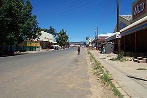
Hlotse (also Leribe) is an important market town in Lesotho. It is situated on the Hlotse River, near the South African border. The town was founded in 1876 by a British missionary, Reverend John Widdicombe. It was a colonial center until Lesotho gained its independence. The population in 2006 was 24,710.
Contents
- Driving in lesotho lowland butha buthe hlotse leribe
- Map of Hlotse Lesotho
- Noma vales briefly describes religion hlotse lesotho summer 2011
- Places of interest
- References
Map of Hlotse, Lesotho
The alternate name, Leribe, comes from the adjacent French Protestant Leribe Mission, founded in 1859 by François Coillard. Hlotse is also called Leribe because it is the camptown in the district of Leribe.
The main Basotho Headquarters for Help Lesotho is in Hlotse.
Noma vales briefly describes religion hlotse lesotho summer 2011
Places of interest
Three different sightseeing locations are the Leribe Craft Center, statue in front of the District Administration office, and an old military lookout.
The Leribe Craft Center sells handmade wool items ranging from scarfs to jackets. The craft center is located on the side of the road as a person comes into Hlotse. The statue in front of the District Administration building dates back to English rule of Lesotho. It is located in the central part of the city. The old military lookout also dates back to English rule and is located in the central part of the city.