
Location Pacific Ocean Highest point Mount Wonvara Elevation 366 m Island group Torres Islands | Highest elevation 366 m (1,201 ft) Population 269 (2009) Area 51 km² Province Torba Province | |
 | ||
Archipelago Vanuatu, Torres Islands | ||
Hiw (sometimes spelled Hiu) is the northernmost island in Vanuatu, located in Torba Province.
Contents
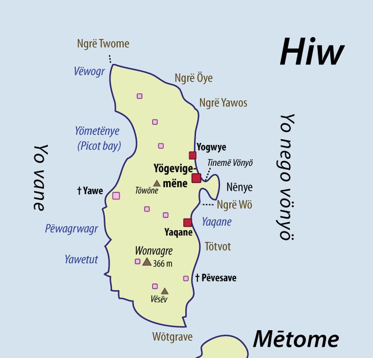
Map of Hiu, Vanuatu
Geography
Hiw is the largest island in the Torres Islands in Torba Province. It is situated east of the Torres Trench, south of Vanikoro in the Solomon Islands. It has an area of 51 square kilometres (20 square miles). The highest point is Mount Wonvara (366 metres (1,201 feet).
Vewoag Point (locally called Ngrë Twome), the northern cape of Hiw, is the northernmost point of land of Vanuatu. 1.6 kilometres (1.0 mile) of Hiw is a submerged coral reef, Ngwey Gakwe (formerly Recif Giraudeau), over which the waves break.
Population
Hiw has a population of about 270 inhabitants.
They are distributed in three villages, all located on the east coast: Yogwye [ˈjɔɰwjə]; Yaqane [jaˈkʷanə]; and the main village Yögevigemëne [ˌjɵɣəˌβiɣəˈmenə], whose name is sometimes shortened to Yugemëne [ˌjʉɣəˈmenə].
The language spoken on the island is also called Hiw.
Transportation
The Torres islands are served by Torres Airport, which is located on the Linua island, south of Hiw.