
Country Japan Prefecture Ibaraki Prefecture - Flower Rose Local time Monday 8:31 AM | Region Kantō - Tree Sakura Population 42,438 (Sep 2015) | |
 | ||
Time zone Japan Standard Time (UTC+9) Weather 5°C, Wind SE at 11 km/h, 85% Humidity Points of interest Seibu Park, Gozenyama Prefectural Natural P, Yasuraginosato Park, Omiya Natural Park, Sannōzan Natural Park | ||
Hitachiōmiya (常陸大宮市, Hitachiōmiya-shi) is a city located in Ibaraki Prefecture, in the northern Kantō region of Japan. As of September 2015, the city had an estimated population of 42,438 and a population density of 122 persons per km². Its total area was 348.45 square kilometres (134.54 sq mi).
Contents
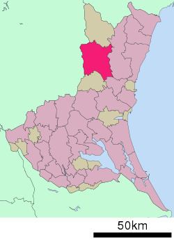
- Map of Hitachiomiya Ibaraki Prefecture Japan
- Geography
- Surrounding municipalities
- History
- Education
- Railway
- Highway
- Notable people from Hitachimiya
- References
Map of Hitachiomiya, Ibaraki Prefecture, Japan
Geography
Hitachiōmiya is located in northeastern Ibaraki Prefecture, bordered by Tochigi Prefecture to the west. The Naka River and the Kuji River flows though the city.
Surrounding municipalities
History
The town of Ōmiya was created within Naka District with the establishment of the municipalities system on April 1, 1889. The city of Hitachiōmiya was established on October 16, 2004, from the merger of Ōmiya with the neighboring the villages of Miwa and Ogawa (all from Naka District), the town of Yamagata, and the village of Gozenyama (both from Higashiibaraki District).
Education
Hitachiōmiya has 11 elementary schools, five middle schools, and two high schools.