
Length: 138.1 mi (222.3 km) East end: Route 1A in Boston | Existed: 1958 – present I-90 I‑91 → | |
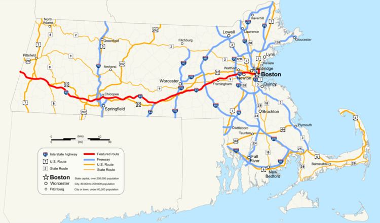 | ||
West end: I-90 / Berkshire Connector in Canaan, NY Counties: Berkshire, Hampden, Worcester, Middlesex, Suffolk | ||
An east-west highway for the state of Massachusetts had been planned for many years before the construction of the Massachusetts Turnpike in the 1960s. The highway began construction in 1955, following a southern path eastwards toward Boston from very near the New York border, where the new road intersected with Massachusetts Route 102 in West Stockbridge, Massachusetts, through Springfield and Worcester and terminating at Route 128 in Weston at the time of its completion in mid-May 1957.
Contents
- Historical overview
- 1950s and 1960s
- Prudential Company
- Second expansion
- New highway
- New interchange
- 2000s
- References
In 1960, it was proposed that the highway be extended into Boston. This proposal was highly controversial because of disputes among landholders, politicians and engineers over the alignment of the proposed Boston Extension. With the economic future of the city on the line, there was enormous pressure from many parties to have the roadway completed.
Historical overview
As Boston’s place as a center of commerce and manufacturing began to grow in the late eighteenth and early nineteenth centuries, the need to move goods to the city's ports from growing mills and factories in communities such as Worcester, Lowell and Providence, Rhode Island, to warehouses in the city required investments in new methods of transportation. The growth of shipbuilding in the city also required the importation of raw materials from the interior regions. Additionally the newly expanded marketplaces within the city, such as Faneuil Hall, needed ways to bring their products to market. In response to these needs, the city and Commonwealth began a process of expanding transportation access to the city. New infrastructure such as bridges, wharves and ferries were established, often by early public-private corporations chartered by the Commonwealth.
The rudimentary system of roads that existed in the region at the time was woefully insufficient for the needs of the merchants, being in need of major overhauls and upgrades that were beyond the financial means of the Commonwealth and municipal governments of the time. The poor quality of the early roadways in the state, as well as others in the young nation, would often make the transportation of goods inland from the ports would often make it economically impractical to transport them via road.
While the military necessity of transporting men and supplies during the revolution helped improve some of the early highways in the states, many of these were not maintained or upgraded after the war’s end. Many roadways lacked bridges and adequate facilities to feed and house travelers on trips that would often take anywhere from a few days to a week to complete. Many communities were also hesitant or unable to provide sufficient capital required to establish or maintain amenities for those who passed through their towns.
On March 16, 1805, the Massachusetts legislature chartered a system of private roads, or turnpikes, designed to help facilitate travel and commerce into general laws of the Commonwealth. These turnpikes, named after the system of tollgates used to collect fares from travelers, were based upon a franchises-like system of private operators who would build, maintain and operate the roads using the toll revenue. The turnpikes often operated at a loss and many folded shortly after their opening.
One such turnpike was designed to run from Roxbury to Worcester and was chartered as the Worcester Turnpike Corporation on March 7, 1806. The Worcester Turnpike was designed to be the primary roadways on the western approach to Boston and utilized a part of the old Connecticut Path along Tremont and Huntington streets, into Brookline and continued west to Worcester along roughly the same route as the modern Route 9. However, the costs of maintaining the road began to spiral as needed bridges in Shrewsbury began to deteriorate and mandates in its charter to run and maintain older and unaffiliated roadways along the route made it difficult for the Corporation to maintain profitability. Like many of its contemporary turnpikes, the Worcester Turnpike eventually succumbed to failure in 1841, had its charter dissolved by the Commonwealth, and the roadway was portioned and control transferred to local municipalities.
One of the primary contributors to the demise of the Worcester Turnpike was the ascendancy of the railroad during the 1830s. Chartered in 1831 by the General Court, the Boston and Worcester Railroad began construction of its line in 1832, and the mainline was completed in July 1835. The newly completed railroad initially utilized the right of way along another failed turnpike, the Central Turnpike, which ran from Boston to Worcester though Brookline, Wellesley, Natick, Framingham and other communities along what is now the Framingham/Worcester MBTA commuter rail line. As illustrated in fig. 1, the railway originally ran through the tidal flats of the Back Bay and its impact on the city was only felt along the southern sections of the city. While originally designed as a long haul railway, the proprietors of the B&W, and other railways, eventually found that there was a willing market for commuter services along the routes and by 1845 had established a series of commuter rail facilities along its route. Through a series of mergers during the next several decades, the Boston and Worcester Railroad eventually evolved into the Boston and Albany Railroad in 1870, Connecting the capitols of Massachusetts and New York state.
As the city slowly began filling in the Back Bay tidal estuary to establish the South End and Back Bay sections of the city, the rail line went from being a lone causeway in the middle of said tidal estuary to a major transportation cut through the heart of the western sections of the city.(See Fig. 2) Besides being a physical separator, the railroad was also a societal and economic barrier as well; while the South End reclamation project was a municipal project that lacked any form of solid planning, the Back Bay reclamation project was a state-run program that established specific ideas of who would reside within the district. The proximity of the railway also led to an unforeseen effect, suburban flight. With the new rail lines in close proximity to the entire city, many wealthier citizens began migrating to the cities and towns west of Boston. This migration put financial burdens for municipal services such as water and sewer, fire and police on these communities, and help led to drives for them to be annexed by Boston, further expanding the city limits. Despite these issues, by the end of the nineteenth century the western railroad and its contemporaries were helping drive the city’s economy by assisting local industries to bring products to Boston’s port, helping it become the second busiest port on the eastern seaboard.
To help accommodate the growth in rail traffic, the Boston and Albany constructed two large rail yards, one in the Allston section of city and another adjacent to the Lennox Hotel on Huntington St, adjacent to the Back Bay.(See Fig. 3) While the Boston and Albany and its contemporaries railroad was constructing new yards, other factors that would foreshadow the decline of the city’s fortunes were manifesting themselves through the late nineteenth century and into the early; traffic to the Port of Boston declined, necessitating the Federal government to dredge the main shipping channels and construct new piers to handle larger vessels; AT&T moved its operations and headquarters from Boston to New York in 1910. The problematic relationship between the city and the business sector under the successive mayoral administrations of James Michael Curley drove a wedge between these businesses and the municipal government, souring employers on Boston. Adding to these problems, a series of economic recessionary periods culminating with the Great Depression coupled with heavy tax burden placed the city’s finances into a tailspin. Despite minor uplifts from the mobilization of the two World Wars, by the end of the World War II the city was in dire straits. Much of the state’s infrastructure west of Boston was in a serious state of decay, with the major east-west routes 2 and 9 in need of significant upgrades. At the same time, rail traffic in the region was becoming financially untenable to utilize for material transportation for newly emerging technology companies of the era due to the rail roads’ outmoded pricing structures and limited geographical reach.
1950s and 1960s
In the period following World War II, Boston had fallen into a deep period of stagnant growth. Its former maritime industries had closed as traffic in the harbor declined, the textile mills that had provided a large portion of the city’s wealth had migrated out of the region seeking new locations that would allow them to maximize revenues, and property development had ground to a halt with virtually no new construction of any impact occurring since the beginning of the Great Depression. Boston retail stalwarts such as Filenes and Jordan Marsh had decided to focus their energies and growth into the suburbs; Boston’s citizens had begun to flee to the same suburban pastures as property taxes in the city skyrocketed. As U.S. News and World Report stated, Boston was “dying on the vine”.
After the end of the war, Massachusetts entered into a period of new highway projects planning that sought to help end the economic malaise the state was suffering from. It was in 1947 that Republican Governor Robert Bradford realized that the Commonwealth needed to implement a standard framework to properly guide the planning and construction of these new roadways. He commissioned a study to produce a new Highway Master Plan for the eastern region, and by 1948 it had been completed. Seeking the political benefits that a major public works project would bring, Bradford put sent his plan to the Democratic-controlled Massachusetts legislature for approval; however the Democrats sat on the project until their candidate, newly elected Democratic Governor Paul A. Dever, took office in January 1949.
It was instead Dever who initiated the program to implement the Highway Master Plan for the city shortly after taking office in 1949. Enjoying a Democratic majority within the State House coupled with a Democratic governor for the first time in the Commonwealth's history, he pushed through a series of highway bills with associated gas tax increases totaling over US$400 million (US$3.97 billion in 2014, adjusted for inflation) between 1949 and 1952. To oversee this undertaking, Dever brought in the former Commissioner of the Massachusetts Department of Public Works, William F. Callahan, to once again head the agency he had helmed from 1934 to 1939. Known for his strong personality and drive to get projects completed, Callahan immediately set out to construct three of the proposed highways: the outer circumferential highway aka route 128, the Southeast Expressway, and the Central Artery through the heart of the Boston’s downtown. These three projects, totaling more than US$92 million (US$913 million in 2014, adjusted for inflation) were seen as being essential to the growth of the city in the future. However, the construction of these roads took such a large portion of funds that the Commonwealth was unable to provide funds for the Western Expressway project. However, before Callahan could oversee the completion of the southern leg of route 128 he was appointed by Dever to run the newly formed Massachusetts Turnpike Authority.
Because of the financial strain created by the bond issues used to construct these other highways, the Commonwealth was unable to afford the costs of floating more bonds to fund the expenditures required to construct the Western Expressway along the Western Approach corridor of Boston. Callahan suggested creating a strong, independent, and semi-public transportation authority that could fund the new expressway by floating its own bond issues and financing them through tolls along the highway while having its own powers of eminent domain to secure the land needed to build it. Utilizing the political goodwill he accrued during his tenure as public works commissioner, primarily through extensive patronage hires, Callahan was able to push his idea for the new authority through the Statehouse with ease. The authority was formed in early 1952, and by 1955 it had issued the required bonds needed to construct a 123 mi (198 km) highway from the New York-Massachusetts border to the recently completed route 128 in Weston. Despite being completed in 1957, many within the Commonwealth quickly realized that the local routes used to get into Boston were still insufficient for the automotive traffic burdens placed upon them.
While the highway construction boom proved to be fortunate for the suburban communities these new roadways passed through, the economy of Boston was still in a fragile state. Realizing that Boston still needed to be connected to the Turnpike to help reverse its flagging economy and reputation as a municipal has-been, Callahan was tasked in 1955 by the Legislature to create an extension into the city designed to facilitate a turnaround of the city’s fortunes. This new highway would connect the Massachusetts Turnpike to the heart of the city with a 12.3-mile extension of the Interstate. It was his plan to bring the tolled Turnpike from its terminus at route 128 in West Newton into the city along the path of the Boston and Albany Railroad and connect it to the Southeast Expressway. This plan was in line with the 1948 Master Highway Plan for the city, which had always called for a Western Expressway to be built into the city. However, with the passage of the Interstate Highway Act in 1956, the Federal Government provided sufficient funds to the states to construct new highways with a ninety percent subsidy—rendering the need for a toll road into the city obsolete.
Compounding the matter, Callahan’s planned extension route was not universally accepted by others within the state, such as newly elected Governor John A. Volpe and Newton Mayor Donald Gibbs, who sought to construct a freeway that would follow a different route between the Borders of Newton, Waltham and Watertown along the Charles River and U.S. Route 20 and be constructed using the funds now being provided by the Federal Highway Administration. Additionally, residents of the city of Newton, who would see significant demolition of neighborhoods within the city along with large portions of its central business district to make way for the Turnpike Extension, were also adamantly against the proposed Boston and Albany routing of the road. Newton, through the terms of two mayors, set about fighting the Turnpike proposal through a series of increasingly futile legislative maneuvers in the General Court. Realizing that the needs and wants of the smaller city could not overcome the influence of Callahan within the state capitol, the smaller city would instead redirect its efforts to blocking the highway at the Federal level through the Interstate Commerce Commission and Federal courts. Affected property owners within Boston who were also looking at the possibility of losing their homes and business followed Newton’s lead by filing a series of state- and federal-level lawsuits that they hoped would derail the proposed extension.
Prudential Company
Adding to Callahan’s numerous problems with those in opposition to the new roadway, the Prudential Life Insurance Company announced that it was in the process of acquiring the 32-acre Boston and Albany Tremont St. rail yard for the purpose of constructing a brand new building and associated complex to house its Northeastern American operations at about the same time as the Commonwealth’s plan to bypass the Turnpike Authority was being announced. This proposed development stood square in the middle of the Boston leg of Callahan’s planned Turnpike extension, and could possibly kill his proposed extension. While many opponents within and out of the city looked upon the Prudential announcement as the possible final-nail-in-the-coffin for Callahan’s proposed toll road, Boston Redevelopment Authority head Edward J. Logue saw Callahan’s Prudential problem as a way to overcome issues the BRA was having in obtaining approval for the Prudential project from the city.
Logue was in many ways the equal to Callahan; a driven man who sought the power to get things done as the head of a semi-independent authority whose structure had been modeled on Callahan’s Turnpike Authority. Logue, who was responsible for many urban renewal projects in Boston at the time, including the construction of Storrow Drive and the West End redevelopment project, realized the Prudential project was essential to Boston’s redevelopment efforts. The main issue holding up the project was a lack of consensus over tax breaks Prudential was demanding in order to move forward with the project. Additionally, several legal decisions were handed down by the Massachusetts Supreme Judicial Court questioning the constitutionality of the land takings required to build the complex.
Adding to the problems associated with the Prudential project, during 1960 and 1961 there was a series of allegations were made against Callahan claiming he had been engaging in illegal activities related to his second tenure as Public Works Commissioner. These allegations included charges of financial kickbacks, bid rigging, and other questionable practices. This led to a corruption trial which threw a pall on his reputation that did not help with his drive to construct the Turnpike extension. On top of the legal allegations, a group of three professors from MIT and Harvard made public allegations that the Turnpike Authority had been using inflated numbers to push through its bond issues, thus artificially inflating their values. This led to failed series of bond issues that critics hoped would prevent the Turnpike Authority from raising the needed funds for construction.
It was in the midst of these many legal problems, that in April 1960 Prudential announced that continuation of their building project was contingent on direct highway access via a toll road along the Boston & Albany Rail Road right of way. Additionally, Prudential would lease air rights to the parcels from the Turnpike Authority and purchase a large portion of bonds issued by the Authority. Despite this agreement, Governor Volpe was still trying to nix the Turnpike's plans along the Boston and Albany right of way, filing the city of Newton’s request with the ICC to stop the construction of the roadway. It was only after a series of meetings between Volpe, Callahan and Prudential executives that finally persuaded the Governor to withdraw the ICC filing and reluctantly support the toll road. With the new deal in place, a not-guilty finding in the criminal case, and public relations push-back to the allegations of market tampering by the Turnpike Authority, the bond measures were once again seen as a sound investment and investors quickly picked up the $175 million (US$1.4 billion in 2014, adjusted for inflation) bond issuance. With the Turnpike-Prudential agreement in place, Logue was able to petition the General Court to once again authorize a land taking deal and tax-deferment bill, which was passed rather quickly and signed by then Governor Foster Focolo. While this new bill was again deemed unconstitutional by the SJC, in its decision the Court provided a framework for the legislature to construct a bill that would pass constitutional muster. The bill also gave Logue’s BRA considerable powers over the redevelopment project, allowing him to rapidly move forward with permit approvals and tax issues. The Turnpike-Prudential deal linked with the Logue and the BRA’s new powers to move the project forward quickly quieted much of the remaining opposition to the new roadway, and cemented the idea of air right development as an integral part of the Turnpike moving forward. By 1965 the Massachusetts Turnpike had been connected to the Central Artery, and the Prudential Center was on its way to completion; however Callahan did not live to see this. On April 24, 1964, Callahan died of a massive heart attack at his home.
Second expansion
The year 1968 saw the beginning of the first major expansion of the Turnpike after the completion of the Boston extension in 1965. While the original design of the roadway called for an eight-lane expressway along the majority of the route, it was only constructed as a four-lane roadway along most of its length until it reached the junction of route 128 where the roadway expanded to three lanes. Starting in 1968 the highway from the Interstate 84 interchange in Sturbridge to Route 128 in Newton was widened from its original four lanes to six; that widening project was completed around 1971. However, the mainline right-of-way was constructed to allow future expansion of the roadway, with most bridges over the highway built with the four-lane roadway in mind, so few bridges had to be rebuilt when it was widened in the late 1960s.
New highway
When designing the Central Artery/Tunnel project in the 1970s and 1980s, the horror stories regarding urban renewal projects such as the construction of the old viaduct in the 1950s weighed heavy on the minds of Frederick Salvucci and his team. It was realized early on that the Commonwealth could not just lay waste to parts of the city and pave them over; the state would have to ensure that construction would balance the needs of the highways against the livability of the city and neighborhoods the project would pass through. Mitigation efforts would be of utmost importance in moving ahead with the project.
Governor Francis Sargent had shut down any ideas of further freeway construction within the MA Route 128 beltway in 1970, thereby cancelling both the I-695 "inner belt" and the Southwest Corridor freeway projects, placing more emphasis on the already-completed Boston extension of I-90, and the work to eventually depress Boston's Central Artery below ground level as the only unbuilt freeway-related construction projects "inside" of Route 128 that would be allowed to go forward.
The notions of using existing rights of way or areas where neighborhood displacement would be minimized were applied to the second extension of the Turnpike as part of the CA/T project. Salvucci deliberately planned to bring the East Boston Extension through areas with little or no occupancy or those properties already owned by the Commonwealth. As a result, East Boston saw almost no takings of buildings or homes through eminent domain or the destruction of neighborhoods because construction was relegated to the unoccupied areas of the South Boston Seaport and Logan. Like the first Turnpike extension, the connection of the Turnpike to East Boston was also designed to provide an economic stimulus to the city, this one to revitalize the desolate Seaport district.
New interchange
While a majority of expansion construction for the roadway focused on the easternmost segment of the highway, in Milbury the Turnpike Authority was quietly adding a new interchange with Route 146. The first major interchange added to the highway west of the city since the construction of interchange 11A for I-495 in 1965, the new junction provided access to the newly reconstructed Route 146.
2000s
A pair of planned mass transit projects will also continue using the railway right of way to help build out the Turnpike. The Beacon Park Rail Yard and ShurFlo Chemical transfer station in Allston, derelict for several years since CSX moved operations out of the city in 2013, are set to be used by the Turnpike to straighten the “kinked” section of the roadway through the area. (Dyer 2) This will allow for newer forms of tolling, expanded rapid transit, reduced pollution and a replacement of a series of ramps and viaducts that cut the area off from the rest of the city. A new local roadway alignment replacing the old ramps and viaducts in place for the past half century will allow commercial development and expansion of Harvard and Boston University campuses into areas now laid fallow or unusable because of the cut.