
Country Tajikistan Time zone UTC+5 Population 22,961 (2001) | Elevation 802 m (2,631 ft) Area 9.6 km² Local time Sunday 10:36 AM | |
 | ||
Weather 6°C, Wind E at 14 km/h, 29% Humidity Province Districts of Republican Subordination | ||
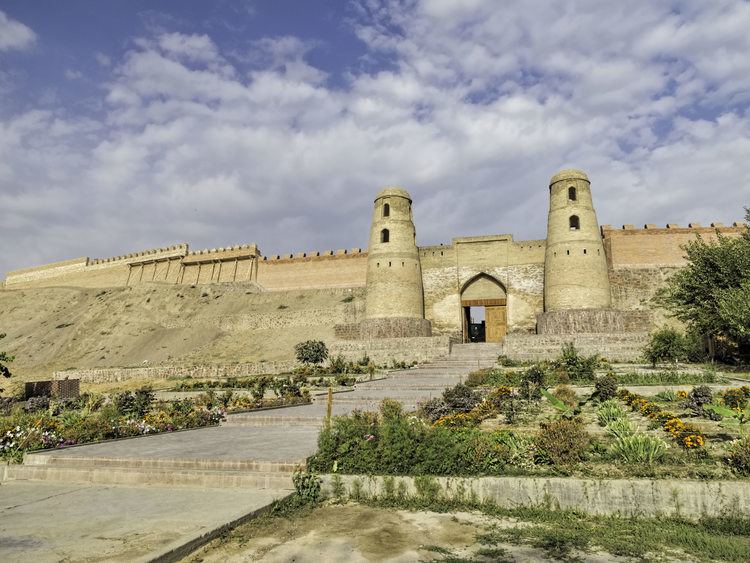
Hisor (Tajik: Ҳисор, Persian: حصار) is a city in western Tajikistan, about 15 km west of Dushanbe. It is the capital of Hisor District, one of the Districts of Republican Subordination. It lies at an altitude of 799–824 m, surrounded by high mountains (Gissar Range to the north, Babatag and Aktau ranges to the south). The Khanaka River, a tributary to the Kofarnihon River, flows through the town. As of 2002, it had a population of 22,961, composed 81.6% of Tajiks, 12.3% Uzbeks, 3.6% Russians, and 2.5% others. It was once an independent Khanate, and then the winter residence of the governor of East Bukhara. The large fort is said to date back to Cyrus the Great and to have been captured twenty one times.
Contents
Map of Hisor, Tajikistan
Hisor was made a city on June 26, 1993.
Climate
The Köppen Climate Classification sub-type for Hisor is "Dfb" or a Warm Summer Continental Climate. The average annual temperature is 14.1 °C (57.4 °F). The warmest month is July with an average temperature of 23.9 °C (79.2 °F) and the coolest month is January with an average temperature of 1.7 °C (35.1 °F). The average annual precipitation is 568mm (22.4") and has an average of 90.5 days with precipitation. The wettest month is March with an average of 107.2mm (4.2") of precipitation and the driest month is August with an average of 0.8mm (0.03") of precipitation.