
Population 236 (2011) Hirstglen Black Duck Creek | Postcode(s) 4359 Postal code 4359 | |
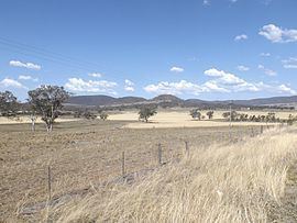 | ||
Hirstglen is a locality in the Toowoomba Region local government area of the Darling Downs, Queensland, Australia. At the 2011 Australian Census Hirstglen and surrounds recorded a population of 236. Part of the southern boundary is marked by Kings Creek, a tributary of the Condamine River. The northern and eastern boundary roughly follows a ridge which marks the watershed of the Condamine.
Map of Hirstglen QLD 4359, Australia
References
Hirstglen, Queensland Wikipedia(Text) CC BY-SA