
Area 58.39 km² Local time Sunday 12:51 PM | Phone number 0240-27-2111 Population 5,005 (Dec 2014) | |
 | ||
Weather 6°C, Wind E at 6 km/h, 60% Humidity Points of interest Futatsunuma Park, Koshayama, Oriki Hot Spring | ||
Hirono (広野町, Hirono-mach) is a town located in Futaba District, Fukushima Prefecture, Japan. As of December 2014, the town had an official registered population of 5,005 and a population density of 85.7 persons per km2, although the current actual resident popular is much lower. The total area was 58.39 square kilometres (22.54 sq mi).
Contents
- Map of Hirono Futaba District Fukushima Prefecture Japan
- Geography
- Surrounding municipalities
- History
- 2011 earthquake and tsunami
- Economy
- Education
- Railway
- Highway
- References
Map of Hirono, Futaba District, Fukushima Prefecture, Japan
Geography
Hirono is located in southern of Fukushima Prefecture, bordering on the Pacific Ocean to the east.
Surrounding municipalities
History
The area of present-day Hirono was part of Mutsu Province, and was included in the holdings of Iwakitaira Domain under the Tokugawa shogunate of Edo period Japan. After the Meiji restoration, on April 1, 1889, the village of Hirono was created within Naraha District, Fukushima. Naraha District became Futaba District in 1896. Hirono was elevated to town status on August 1, 1940.
2011 earthquake and tsunami
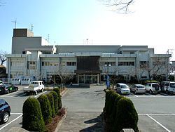
The eastern, coastal portion of Hirono was inundated by devastating tsunami flood waters following the magnitude 9.0 2011 Tōhoku earthquake and tsunami off its coastline on March 11, 2011. Following the Fukushima Daiichi nuclear disaster, the town was included in the emergency evacuation preparation zone, as it was just outside the 20 kilometer exclusion zone; however, the town government recommended that all residents evacuate and all civic services were shut down. Although the central government advised that it was safe to return in September 2011, the town government maintained its evacuation recommendation until April 2012. The town hall reopened on March 1, 2012 in preparation for the return of residents and the radioactive decontamination of schools; however, a ban on agriculture remained in place. However, residents were slow to return, with only 1,352 of the registered 5,005 residents having returned by February 2014.
Economy
The economy of Hirono was formerly heavily dependent on agriculture. The fossil-fuel powered Hirono Power Station located directly at the Pacific Ocean about 3 km north of the town was also a major employer. Although damaged by the 2011 Tōhoku earthquake and tsunami Tepco managed to return the power station to operation four months later.
Education
Hirono had one high school, one middle school and one elementary school in March 2011.