
OS grid reference SP932615 Local time Sunday 12:35 AM | Region East Sovereign state United Kingdom Postcode district NN29 Dialling code 01933 | |
 | ||
Weather 11°C, Wind SE at 6 km/h, 84% Humidity | ||
Hinwick is a hamlet in northwest Bedfordshire, England, United Kingdom; it is around nine miles north west of Bedford and is about 1 km (0.62 mi) east of the county border with Northamptonshire which is also the postal county. The hamlet is in the parish of Podington (where the 2011 Census population was included), which is sometimes called "Podington and Hinwick" and this parish was within the Hundred of Willey. Hinwick was recorded in the Domesday Book in 1086 as Haneuuich, also spelt Heneuuiche or Henewich and has also been recorded as Henewic and Hynewyk from the 13th century. Today Hinwick is within the electoral ward of Harrold which is in the Borough of Bedford.
Map of Hinwick, Wellingborough, UK
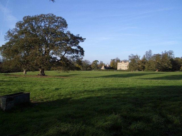
Located around two miles south east of Hinwick are RAF Podington and Santa Pod Raceway. At the cross roads, to the north side of the hamlet is Hinwick House, a manor house in its own grounds, built in 1709-14.
Less than one mile north north east along the main road is the village of Podington. Other nearby villages include, Farndish to the north and Wollaston to the north west, both just within two miles and also Bozeat around two and a half miles south west. The centre of the larger town, Rushden, is around three and a half miles north north east.