
Country United States Elevation 1,122 ft (342 m) Area code(s) 937 Zip code 45133 Population 6,600 (2013) | Time zone EST (UTC-4) FIPS code 39-35560 | |
 | ||
Weather -1°C, Wind NW at 13 km/h, 39% Humidity University | ||
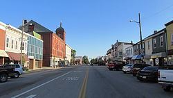
Hillsboro is a city in and the county seat of Highland County, Ohio, United States. The population was 6,605 at the 2010 census.
Contents
- Map of Hillsboro OH 45133 USA
- History
- Geography
- 2010 census
- 2000 census
- Education
- Newspapers
- Radio
- Notable people
- References
Map of Hillsboro, OH 45133, USA
History
Hillsboro was platted in 1807, and most likely named for the hills near the original town site.
Geography
Hillsboro is located at 39°12′21″N 83°36′50″W (39.205764, -83.613764).
According to the United States Census Bureau, the city has a total area of 5.43 square miles (14.06 km2), all land.
Hillsboro is located at the junction of U.S. Routes 50 and 62 and State Routes 73, 124, 138, and 247.
The largest city near Hillsboro is actually Dayton with a distance of 56.3 miles. Followed by Cincinnati at 59.7 miles and then Columbus at 66.0 miles.
2010 census
As of the census of 2010, there were 6,605 people, 2,755 households, and 1,612 families residing in the city. The population density was 1,216.4 inhabitants per square mile (469.7/km2). There were 3,181 housing units at an average density of 585.8 per square mile (226.2/km2). The racial makeup of the city was 90.0% White, 5.8% African American, 0.3% Native American, 0.8% Asian, 0.2% from other races, and 2.9% from two or more races. Hispanic or Latino of any race were 1.3% of the population.
There were 2,755 households of which 30.5% had children under the age of 18 living with them, 37.7% were married couples living together, 16.5% had a female householder with no husband present, 4.3% had a male householder with no wife present, and 41.5% were non-families. 37.1% of all households were made up of individuals and 18.2% had someone living alone who was 65 years of age or older. The average household size was 2.28 and the average family size was 2.97.
The median age in the city was 38.7 years. 24.3% of residents were under the age of 18; 9.1% were between the ages of 18 and 24; 24.1% were from 25 to 44; 22.4% were from 45 to 64; and 20.1% were 65 years of age or older. The gender makeup of the city was 44.9% male and 55.1% female.
2000 census
As of the census of 2000, there were 6,368 people, 2,686 households, and 1,633 families residing in the city. The population density was 1,227.1 people per square mile (473.7/km²). There were 2,971 housing units at an average density of 572.5 per square mile (221.0/km²). The racial makeup of the city was 90.58% White, 6.39% African American, 0.20% Native American, 1.07% Asian, 0.03% Pacific Islander, 0.38% from other races, and 1.35% from two or more races. Hispanic or Latino of any race were 0.94% of the population.
There were 2,686 households out of which 28.6% had children under the age of 18 living with them, 43.8% were married couples living together, 13.6% had a female householder with no husband present, and 39.2% were non-families. 35.8% of all households were made up of individuals and 18.2% had someone living alone who was 65 years of age or older. The average household size was 2.26 and the average family size was 2.93.
In the city, the population was spread out with 24.2% under the age of 18, 9.9% from 18 to 24, 23.9% from 25 to 44, 20.7% from 45 to 64, and 21.3% who were 65 years of age or older. The median age was 39 years. For every 100 females there were 82.8 males. For every 100 females age 18 and over, there were 75.9 males.
The median income for a household in the city was $25,998, and the median income for a family was $34,750. Males had a median income of $30,984 versus $22,665 for females. The per capita income for the city was $15,400. About 13.5% of families and 18.1% of the population were below the poverty line, including 27.6% of those under age 18 and 11.7% of those age 65 or over.