
 | ||
Hill 400 (German: Burgberg) is the name given by Allied forces during World War II to a 400.8 metres (1,315 ft) high hill located 1 kilometre (0.62 mi) east of the centre of Bergstein, a village in the Eifel region of Germany.
Contents
Map of Hill 400, 52393 H%C3%BCrtgenwald, Germany
The hill, which in medieval times was the site of Berenstein Castle, as well as a section of the Siegfried Line from the Second World War, now has an observation tower at the summit.
After Berenstein Castle was destroyed around the year 1200, the material was used to build Nideggen Castle and the tower of the church in Bergstein.
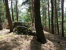
Today this hill is predominantly called by its civil name Burgberg (English: castle hill). This small mountain provides a view over the entire Hürtgen Forest (German: Hürtgenwald) area and was strategically important as a vantage point and German artillery station during the Battle of Hürtgen Forest in 1944.
Location
The Hürtgen Forest occupies a wooded plateau and its deep, heavily forested valleys between treeless ridgelines. Hill 400 dominates the area and is at the end of the Brandenberg–Bergstein ridge, next to the Rur valley.
History
On Thursday, December 7, 1944, the New York Times reported that the 2nd Ranger Battalion had captured Bergstein, and castle hill. In a follow up report on the December 11 the Times reported that "enemy attempts to regain Hill 400 east of Bergstein have been repulsed."