
 | ||
An estimated total of 850 km (530 mi) of roads and highways are spread across Nunavut. Over the next decade the amount of roads are expected to increase due to the increase of population.
Contents
- Tibbitt to Contwoyto Winter Road
- Arctic Bay to Nanisivik Highway
- Eureka Highway
- Federal Road Iqaluit
- Niaqunngusiariaq Road Iqaluit
- Alert to Alert Airport Road
- Ovayok Road
- Coral Harbour Airport Road
- References
Nunavut is the only province/territory that is not connected by roads to other parts of Canada. A road link to Manitoba is at planning stage. This road, if ever built, will cost an estimated $1.2 billion to build and another $3 million a year to maintain. This road is expected to run 1,100 km (680 mi) from Sundance, Manitoba to Rankin Inlet, Nunavut. However, a study showed that the cost of building the road would likely far outweigh any potential economic benefits.
Most vehicles in the territory are moved from community to community and in and out of the territory by large barges that move during the summer shipping season. Less commonly, vehicles may be flown in on a cargo plane. Car companies will usually fly vehicles in to test them in Arctic conditions.
There is one winter road that provides access to the western portion of Nunavut from the Northwest Territories during the months of February to March. In recent winters, this road has not been constructed as far as Nunavut.
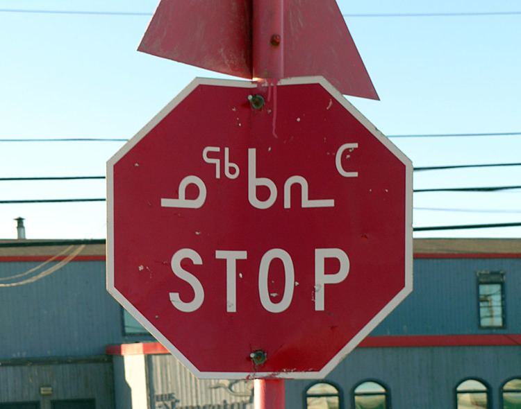
Highways in Nunavut, the few that exist, are not yet numbered. Street signs are in English, Inuktitut and Inuinnaqtun.
Compared to the rest of Canada, maintaining a vehicle in Nunavut is expensive. Rough roads and harsh weather result in expensive upkeep for vehicles, and despite being subsidised by the government, gas prices are among the highest in Canada. Parts can take an extremely long time to ship in and are very expensive. Mechanics also charge a premium, since very few do business in the territory. Due to the lack of a cohesive road network, aircraft are still the preferred way to travel, along with ATVs through most of the year, snowmobiles in winter, and boats during the summer months. Travel by dog sled has largely disappeared, although recreational dog-sledding is still common.
About 4000 vehicles are registered in the territory. Many makes and models of vehicles can be found in the territory, but the most common are heavy-duty four-wheel-drive vehicles such as sport utility, jeeps and full-size vans. A wide range of vehicles can be found in Iqaluit, where the government tends to do most of its business and the road system consists of paved and chip-sealed portions, although it too is primarily dirt.
Despite Nunavut's isolation from the rest of Canada's road network, provincial licence plates can be found from Newfoundland and Labrador, Quebec, and Northwest Territories, as well as government plates from the Department of National Defence; vehicles of all provincial plates can sometimes be found in the territory. Nunavut, like the Northwest Territories, is one of the few jurisdictions in the world where non-rectangular licence plates can be found, as these two territories issued plates in the shape of a polar bear. Nunavut no longer issues these.
Vehicles can display their old provincial plates for 90 days before they must be registered in the territory.
The only road that links communities is the unnamed, unnumbered road (see below) between Arctic Bay and Nanisivik, although Nanisivik was closed in 2005, and being contaminated with lead, is unlikely to be occupied in future. This road is used to access Nanisivik Airport and for an annual Marathon.
An ice road, almost entirely within the Northwest Territories, from Yellowknife, Northwest Territories to Contwoyto Lake (see below), open for just two months per year, is the only surface vehicle access from the North American highway network that reaches across the Nunavut border, but there are no settlements at the end, only diamond mining operations and worker lodgings. The road is a dangerous one for truckers, who risk breaking through the ice.
A road was briefly considered in 2004 for construction between Iqaluit and Kimmirut (formerly known as Lake Harbour), but it would be four times longer than the direct air-distance between the communities, and the idea was dropped.
A proposal is in place for a billion-dollar highway to Rankin Inlet, Nunavut from Gillam, Manitoba with a connection to Churchill, Manitoba, a route that was chosen over two other alternatives from Thompson and Lynn Lake. This highway along the west shore of Hudson Bay would be the first true highway into Nunavut from the provinces.
Tibbitt to Contwoyto Winter Road
This road was once a way to drive to Nunavut from the South. The winter road services a number of mines in the Western edge of Nunavut as well as mines in the Northwest Territories. The entire road is 605 km (376 mi) and is the world's longest heavy haul ice road. It is open between February and March each year. Since the closure of the Lupin and Jericho mines, only the first 400 km (250 miles) of the Tibbett to Contwoyto Winter Road has been constructed each winter, and it is a former road in Nunavut.
A 210 km (130 mi) all-weather extension was once planned from Contwoyto Lake to the tiny town of Bathurst Inlet where a port would be built to provide shipping to nearby communities.
Arctic Bay to Nanisivik Highway
This 21 km (13 mi) stretch of Highway connects the town of Arctic Bay to the former mining town of Nanisivik. The road also gained world fame for a number of years when it was used for the Midnight Sun Marathon run but has become less important when the mine shut down in 2002. However, it should benefit from the Canadian Forces planned $100 million expansion of the Nanisivik deep water port and airport announced on August 10, 2007, by Prime Minister Stephen Harper.
Eureka Highway
This is a 20 km (12 mi) all-weather highway that provides the link from Eureka Weather Station to CFB Eureka and the Eureka Airport.
Federal Road, Iqaluit
The main road in Iqaluit, this road provides access from the Airport to the City Centre and to the Nunavut Legislature Building.
Niaqunngusiariaq Road, Iqaluit
This road provides access from Iqaluit to the original community of Apex (Niaqunguut). The road was built by the United States Army Corps of Engineers in order to keep their soldiers busy while they waited for the sea-ice to open up to let them go home in the summer of 1956.
The bridge across Kujesse (Apex Creek) was a gift from the Government of Ontario's Department of Highways the following year.
The inaugural trip down Apex Hill led to a truckload of soldiers in the ditch. The brakes on the army vehicle had not been tested for several years in the "flats" of what was then Frobisher Bay, and they did not hold when tested on the new road. Only pride was injured when the truck hit the ditch on its first trip.
Prior to the road being built, schoolchildren living near the base at "Ikaluit" walked to Federal Day School in Apex over the sea ice or stayed with relatives in Apex, as the base in Frobisher Bay was "off limits" to Inuit.
Today, this road has been developed along much of its 5 km (3 mi) length. It is now one of the busiest roads in the territory, a typical rush hour sustains 500 cars an hour, although rush hour itself is locally called the "rush minute".
Alert to Alert Airport Road
This roughly 6 km (4 mi) stretch of all-weather road is the most northern stretch of road in the world. This road provides access from CFB Alert to the Alert Airport.
Ovayok Road
Runs from Cambridge Bay eastward 17 km (11 mi) to Ovayok Territorial Park (Mount Pelly). Another road runs west approximately 14 km (9 mi) from the hamlet.
Coral Harbour Airport Road
Connects the hamlet of Coral Harbour on Southampton Island with its airport, 11 km (7 mi) away.