
Existed: 2006 – present Length 190.4 km | Constructed 2006 | |
 | ||
Major cities | ||
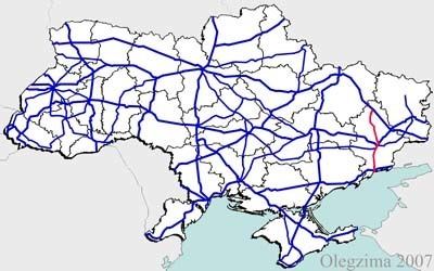
H20 is an important Ukraine national highway (H-highway) in the Donetsk Oblast, Donbas, Ukraine, running mainly north–south and connecting Sloviansk though Donetsk with Mariupol on the shores of Taganrog Bay in the Sea of Azov near the mouth of the Kalmius River. It passes through Kramatorsk, Druzhkivka, Oleksijevo-Druzhkivka & Osykove, Kostiantynivka, Berestok, Romanivka, Kamianka in Yasynuvats’kyi, Makiivka, Donetsk, Dolya in Volnovas'kyi, Syhnal'ne-Olenivka in Marinskyi, Berezove in Marinskyi, Novotroits'ke in Volnovas'kyi, Buhas, Volnovakha, Dmytrivka, Polkove, Pryvil'ne, Hranitne, and Kasyanivka in Telmanove Raion.
Contents
Before 1998, it was P40. From 1998 to 2006, it was P19.
War in Donbass
Significant armed conflict has occurred along and near H20 during the War in Donbass. On January 13, 2015, pro-Russia militants attacked a bus near Buhas and Volnovakha.
Main route
Main route and connections to/intersections with other highways in Ukraine.