
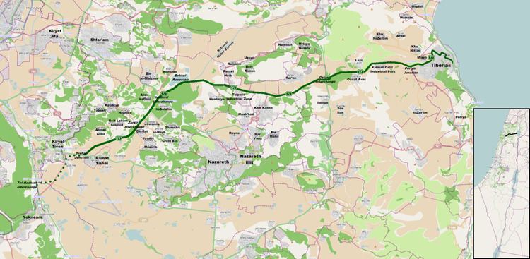
West end: Yishai Junction Length 42 km | East end: Bank Leumi Junction | |
 | ||
Major cities | ||
Highway 77 is an east-west highway in northern Israel. It crosses the Lower Galilee in the region of Beit Netofa Valley. The road leads from Yishai junction next to Ramat Yishai to Tiberias. It is 42 km long (not including the 5 km extension to Tel Qashish which is currently under construction).
Completion of the western-most section of the road, from Tel Qashish/Highway 6 to the future Yishai interchange will form the final link of a freeway corridor extending from southern Israel to the central Galilee. Construction on this section started in late 2016 at a cost of NIS 630 million (appx. US$200 million). The Hamovil–Golani section is also being converted to a freeway at the same time at a cost of NIS 360 million, making the entire western 33 km of the road a freeway by the year 2020.