
Country Canada Elevation 602 m Local time Saturday 12:34 AM | Province Alberta Census division 17 Time zone MST (UTC-7) Population 2,564 (2016) Area code Area code 780 | |
 | ||
Weather -18°C, Wind E at 11 km/h, 82% Humidity | ||
Roll over at high prairie
High Prairie is a town in northern Alberta, Canada within Big Lakes County. It is located at the junction of Highway 2 and Highway 749, approximately 89 kilometres (55 mi) northeast of Valleyview and 118 kilometres (73 mi) west of Slave Lake.
Contents
- Roll over at high prairie
- Map of High Prairie AB Canada
- High prairie town light up
- History
- Demographics
- Economy
- Attractions
- Government
- Media
- Notable people
- Recognition
- References
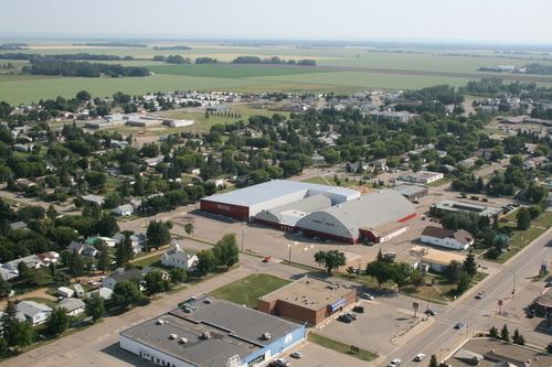
Map of High Prairie, AB, Canada
High prairie town light up
History
High Prairie's first post office opened in 1910. In 1914, the alignment of the Edmonton, Dunvegan and British Columbia Railway, later known as the Northern Alberta Railway, was chosen to go through High Prairie instead of Grouard to the northeast. As a result, many residents and businesses from Grouard relocated to High Prairie once the Edmonton, Dunvegan and British Columbia Railway was built.
With an estimated population of 600 people, High Prairie was incorporated as a village on April 6, 1945 and subsequently as a town on January 10, 1950.
Demographics
In the 2016 Census of Population conducted by Statistics Canada, the Town of High Prairie recorded a population of 2,564 living in 949 of its 1,116 total private dwellings, a 2999860000000000000♠−1.4% change from its 2011 population of 2,600. With a land area of 7.22 km2 (2.79 sq mi), it had a population density of 355.1/km2 (919.8/sq mi) in 2016.
In the 2011 Census, High Prairie had a population of 2,600 living in 972 of its 1,069 total dwellings, a -6.6% change from its 2006 adjusted population of 2,785. With a land area of 7.92 km2 (3.06 sq mi), it had a population density of 328.3/km2 (850.2/sq mi) in 2011. The population of the town, according to its 2007 municipal census is 2,836.
Economy
High Prairie's main industries include agriculture, forestry, oil and gas, and service industry.
One of its main employers was the Tolko OSB Mill that was built in 1995 however the plant was closed in February, 2007, putting more than a 100 employees out of work. West Fraser Mills purchased the Buchanon lumber mill in 2014 and is now the main employer for High Prairie with 150 employees.
Attractions
Due to its proximity to the western shores of Lesser Slave Lake, High Prairie has a thriving tourism industry, particularly in the warmer summer months. There are many attractions at the lake, including events such as the Golden Walleye Classic.
Winagami Lake Provincial Park, approximately 12 kilometres (7.5 mi) to the north of High Prairie, and Kimiwan Lake, approximately 49 kilometres (30 mi) to the northwest, are attractions for bird-watching enthusiasts. Winagami Lake and Kimiwan Lake are within the general area where three major migration paths meet – the Central Flyway, the Mississippi Flyway, and the Pacific Flyway.
Government
High Prairie is governed by a town council, a mayor and six council members, each of whom serve four-year terms. Federally, it is part of the Fort McMurray—Athabasca electoral district. In the next federal election, it will become part of the newly formed riding of Peace River—Westlock.
Media
Media outlets serving High Prairie and surrounding area include CKVH The Fox, CIRE-TV (the local community channel), and the South Peace News, a local community newspaper.
Notable people
Recognition
In 2001, High Prairie was recognized for its state-of-the-art water treatment system and it was awarded 4 'blooms' by Communities in Bloom, a non-profit organization that encourages environmental responsibility and beautification in Canadian communities.