
Population 5,852 Metropolitan borough Stockport Country England Area 675 km² Metropolitan county Greater Manchester | OS grid reference SJ955852 Region North West Sovereign state United Kingdom Local time Saturday 6:58 AM | |
 | ||
Weather 8°C, Wind S at 10 km/h, 88% Humidity | ||
Save the greenbelt and farms in high lane
High Lane is a village in the Metropolitan Borough of Stockport, Greater Manchester, England. Historically within Cheshire, it is 5 miles (8.0 km) from Stockport, on the Macclesfield Canal. It has a population of 5852.
Contents
- Save the greenbelt and farms in high lane
- Map of High Lane Stockport UK
- The old school house high lane jolley co property for sale
- Governance
- Geography
- Demography
- Landmarks
- Transport
- Education
- Religious sites
- Public services
- Notable residents
- References
Map of High Lane, Stockport, UK
The old school house high lane jolley co property for sale
Governance
High Lane lies in the Marple South ward of Stockport Metropolitan Borough Council. It lies in the Hazel Grove parliamentary constituency and the current Member of Parliament (from 2015) is William Wragg, a member of the Conservatives.
Geography
High Lane lies five miles (8 km) to the southeast of Stockport. It is bordered by the villages of Marple to the north; Hazel Grove to the west; Disley to the east; Poynton to the south. It lies on the A6 road (which goes from London to Carlisle). Most of the village is spread along this road.
High Lane lies in the foothills of the Pennines, and on clear days it affords some excellent views of the city of Manchester and surrounding towns.
Demography
The population is 5,852. 95% of the population are White British. 82% of the population give their religion as Christian, and 9.8% have no religion. 64% of the population are economically active; 24% are retired.
Social class:
Landmarks
There is a war memorial in the centre of the village. At the edge of the village is Wybersley Hall. High Lane War Memorial Village Hall (highlanevillagehall.co.uk) sits in High Lane Park overlooking two junior football pitches.
Transport
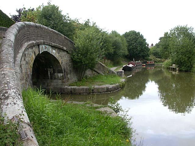
The village sits on the Macclesfield Canal, the Middlewood Way and the A6, a major trunk road in England connecting Luton in the south with Carlisle in the north. The nearest railway station to High Lane is Middlewood. The very long Disley Tunnel, on the Hope Valley Line, passes underneath the village.
Until 1970 there was a railway station in the village, on the Macclesfield, Bollington and Marple Railway.
Education
High Lane has two schools: High Lane Primary School and Brookside Primary School.
Religious sites
Public services
There are three parks in High Lane, Brookside Park, Windlehurst Park and High Lane Park, which is the largest and in 2000 had a small skatepark installed. In the summer of 2010 renovations were completed and an extension to the children's play area was constructed. "Windlehurst Park" is known to many locals as "the little park". There has now been another park built on Windlehurst called Winstanley Park which has been named after "Sir Nicholas Winstanley" a local author.