
Elevation 1,731 m | ||
 | ||
Similar Heimgarten, Jochberg, Benediktenwand, Brauneck, Rabenkopf | ||
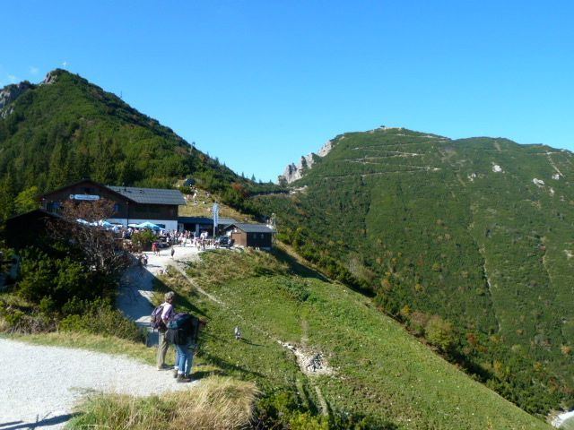
The Herzogstand is a mountain in the Bavarian foothills of the Alps, 75 kilometres (47 mi) south of the city of Munich. It has an elevation of 1,731 metres (5,679 ft) and is northwest of Lake Walchen. Maximilian II of Bavaria had a hunting lodge built underneath today's so-called Herzogstand-house in 1857. His successor, King Ludwig II, had a royal lodge built further up the mountain in 1865. The Herzogstand Aerial Tramway, renewed in 1994 following a fire in 1992, runs to Herzogstand-house at 1,575 metres (5,167 ft) above sea level, and then continues on to the summit of Farnkopf at 1,627 metres (5,338 ft).
Contents
Map of Herzogstand, 82444 Schlehdorf, Germany
The most popular ascent (AV way 446) leads from the valley station of the aerial tramway across the south side to Herzogstand-house and on to the summit of the mountain. An alternative descent leads along the somewhat exposed but well-secured ridge to the Heimgarten mountain (1,790 metres/5,870 ft), passing a lodge to the south of the Ohlstaedter Alm (1,423 metres/4,669 ft). The descent east of the Rotwandkopf continues down to the spa town of Walchensee (Kochel).
TransmitterEdit
The summit of Herzogstand has been used since 1920 for radiotechnical purposes; a VLF transmission antenna was erected between 1920 and 1934. Today, an FM radio transmitter on Fahrenbergkopf broadcasts the following stations: