
Postcode(s) 4817 Postal code 4817 | ||
 | ||
LGA(s) City of TownsvilleCharters Towers Region | ||
Hervey Range is a rural locality split between the City of Townsville and the Charters Towers Region, Queensland, Australia.
Contents
Map of Hervey Range QLD 4817, Australia
Geography
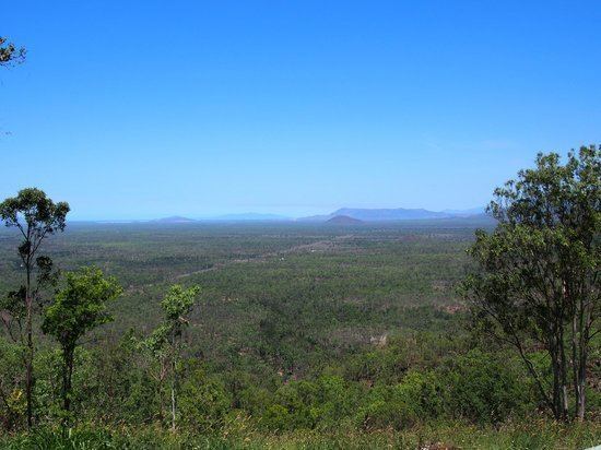
As the name suggests, the locality includes the Hervey mountain range. The split between the two local government areas roughly follows the ridge line with the Townsville City Council responsible for the coastal (eastern) side of the locality and Charters Towers Regional Council responsible for the inland (western) side of the locality. Apart from the ridge itself, the land on the Townsville side is generally much lower (50–100 metres above sea level) compared with the higher land on the Charters Towers side (550–600 metres about sea level).
History
The mountain range and the locality were both named by Phillip Somers after Matthew Hervey of Dotswood pastoral station. Somers and Hervey were co-owners of Dotswood station and Somers was also a member of Allan Cunningham's expedition. Barringha is the local Aboriginal name for the Hervey Range which is also their name for the Western Silver Wattle.
Heritage listings
Hervey Range has a number of heritage-listed sites, including: