
Admin. region Münster Time zone CET/CEST (UTC+1/+2) Elevation 75 m Population 62,235 (31 Dec 2010) | Postal codes 45699, 45701 Area 37.31 km² Local time Friday 3:31 PM | |
 | ||
Weather 12°C, Wind NW at 5 km/h, 44% Humidity | ||
Herten is a town and a municipality in the district of Recklinghausen, in North Rhine-Westphalia, Germany. It is situated in the industrial Ruhr Area, some 5 km (3.1 mi) west of Recklinghausen.
Contents
Map of Herten, Germany
Herten was the seat of the governors of the County of Vest Recklinghausen, an autonomous state within the Archbishopric of Cologne.
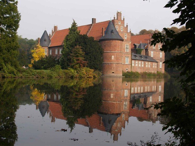
Its best known sights are the moated red brick castle of Schloss Herten, dating back to the 14th century, and the "altes Dorf Westerholt" (Westerholt old village) with its many historic half-timbered houses.
Town area
Herten covers an area of 37.31 km2, with a maximum north-south extent of 9.5 km, and a maximum east-west extent of 6.5 km. The municipality's highest natural point is in Scherlebeck, close to the border with Recklinghausen, with an altitude of 110 m.
Herten is divided into the following urban districts:
Neighbouring towns
Herten borders Marl in the north, Recklinghausen in the east, Herne in the south, and Gelsenkirchen in the west.
International relations
Herten is twinned with: