
Length 3.7 km (2.3 mi) Area 3 ha | Population Uninhabited | |
 | ||
Similar Yarra River, Coode Island, Sunday Island, Como House, Yarra Bend Park | ||
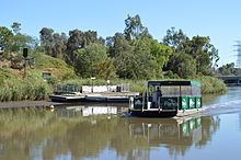
Herring island environmental sculpture park south yarra
Herring Island is an Antarctic rocky island, 3.7 km (2 nmi) long, lying 1.9 km (1 nmi) east of Cloyd Island in the south part of the Windmill Islands. It was first mapped from air photos taken by USN Operation Highjump and Operation Windmill in 1947 and 1948. Named by the US-ACAN for Lt. Charles C. Herring, USN, photographic officer with Operation Windmill parties which obtained air and ground photos of the area in January 1948.
Contents
- Herring island environmental sculpture park south yarra
- Map of Herring Island Richmond VIC 3121 Australia
- A visit to herring island environmental sculpture park
- Foster Bluff
- References
Map of Herring Island, Richmond VIC 3121, Australia
A visit to herring island environmental sculpture park
Foster Bluff
Foster Bluff is a conspicuous rock bluff surmounting the shore in the southwest part of the island. It was named by the US-ACAN for Danny L. Foster, meteorologist and also a member of the Wilkes Station party of 1962.
References
Herring Island Wikipedia(Text) CC BY-SA