
Population 247 253 (2011 Census) Civil parish Herriard Local time Friday 1:33 PM District Basingstoke and Deane | OS grid reference SU637523 Sovereign state United Kingdom Dialling code 01256 | |
 | ||
Weather 9°C, Wind S at 16 km/h, 97% Humidity | ||
Herriard is a village and civil parish in the Basingstoke and Deane district of Hampshire, England. Its nearest town is Basingstoke, which lies 4.6 miles (7.4 km) north. The village is situated mainly on the A339 road between Alton, and Basingstoke. At the 2001 census it had a population of 247, increasing marginally to 251 at the 2011 Census. It was formerly served by the now-disused Herriard railway station on the Basingstoke and Alton Light Railway.
Contents
Map of Herriard, Basingstoke, UK
Governance
The village of Herriard is part of the civil parish of Herriard and is part of the Upton Grey and the Candovers ward of Basingstoke and Deane borough council. The borough council is a Non-metropolitan district of Hampshire County Council.
Geography
The parish also contains the village of Southrope and the hamlet of Nashes Green. It borders the Hampshire parishes of Winslade to the north, Tunworth to the north east, Weston Patrick to the east, Lasham to the south and Ellisfield to the west.
Buildings
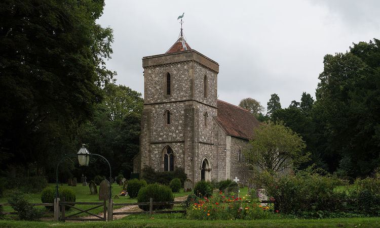
St. Mary's Church in Herriard was built by Sir Richard de Herriard around 1200. There was a major refurbishment and the western tower was added in 1878 for Francis Jervoise. Herriard House was a Queen Anne mansion demolished in the 1960s. It was the home of the Jervoise family.
Notable residents
Economy
Herriard is home to a number of businesses, such as AVS Fencing Supplies (formerly the Herriard Sawmills site), mixing console manufacturer Audient, and medical communications consultancy Strategen.