
Country United States FIPS code 27-28520 Elevation 437 m Population 798 (2013) Area code 218 | Time zone Central (CST) (UTC-6) GNIS feature ID 0644879 Zip code 56551 Local time Thursday 12:21 PM | |
 | ||
Weather -9°C, Wind NW at 19 km/h, 46% Humidity Area 8.754 km² (8.651 km² Land / 10 ha Water) | ||
Henning is a city in Otter Tail County, Minnesota, United States. The population was 802 at the 2010 census.
Contents
Map of Henning, MN 56551, USA
History
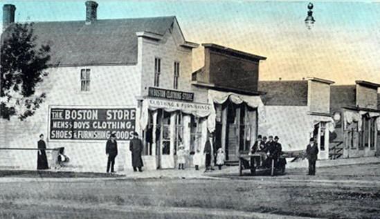
Henning was incorporated in 1887, and named for John O. Henning, a pharmacist.
Geography
According to the United States Census Bureau, the city has a total area of 3.38 square miles (8.75 km2), of which 3.34 square miles (8.65 km2) is land and 0.04 square miles (0.10 km2) is water.
Minnesota State Highways 108 and 210 are two of the main routes in the community, and Minnesota State Highway 29 is nearby.
2010 census
As of the census of 2010, there were 802 people, 364 households, and 181 families residing in the city. The population density was 240.1 inhabitants per square mile (92.7/km2). There were 438 housing units at an average density of 131.1 per square mile (50.6/km2). The racial makeup of the city was 97.0% White, 0.2% African American, 0.1% Native American, 1.2% Asian, 0.1% from other races, and 1.2% from two or more races. Hispanic or Latino of any race were 0.7% of the population.
There were 364 households of which 22.3% had children under the age of 18 living with them, 40.9% were married couples living together, 6.6% had a female householder with no husband present, 2.2% had a male householder with no wife present, and 50.3% were non-families. 47.0% of all households were made up of individuals and 32.1% had someone living alone who was 65 years of age or older. The average household size was 2.10 and the average family size was 3.03.
The median age in the city was 50.1 years. 21.2% of residents were under the age of 18; 5.4% were between the ages of 18 and 24; 18.8% were from 25 to 44; 22.4% were from 45 to 64; and 32.2% were 65 years of age or older. The gender makeup of the city was 46.0% male and 54.0% female.
2000 census
As of the census of 2000, there were 719 people, 366 households, and 181 families residing in the city. The population density was 232.4 people per square mile (89.8/km²). There were 406 housing units at an average density of 131.2 per square mile (50.7/km²). The racial makeup of the city was 98.19% White, 0.42% Native American and 1.39% Asian.
There were 366 households out of which 19.4% had children under the age of 18 living with them, 41.5% were married couples living together, 5.2% had a female householder with no husband present, and 50.5% were non-families. 48.1% of all households were made up of individuals and 33.6% had someone living alone who was 65 years of age or older. The average household size was 1.95 and the average family size was 2.80.
In the city, the population was spread out with 19.5% under the age of 18, 7.0% from 18 to 24, 18.8% from 25 to 44, 21.7% from 45 to 64, and 33.1% who were 65 years of age or older. The median age was 49 years. For every 100 females there were 80.7 males. For every 100 females age 18 and over, there were 77.1 males.
The median income for a household in the city was $21,944, and the median income for a family was $31,932. Males had a median income of $30,417 versus $20,972 for females. The per capita income for the city was $15,450. Below the poverty line were 19.0% of people, 8.1% of families, 19.7% of those under 18 and 27.0% of those over 64.