
Population 4,417 (2011 census) Area 2.7 km² | Postcode(s) 4011 Postal code 4011 | |
 | ||
Location 9 km (6 mi) from Brisbane | ||
Hendra is a suburb of the city of Brisbane, Queensland, Australia. It lies roughly six kilometres north-east of Brisbane central business district.
Contents
Map of Hendra QLD 4011, Australia
History
Hendra was originally a farming district, an expansion of the Nundah settlement. The crops were citrus fruits, grapes and pineapples. There were also dairy herds.
Heritage listings
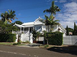
Hendra has a number of heritage-listed sites, including:
Hendra today
Hendra is home to an abundance of restaurants and eateries of all price ranges, including local cafés, take-aways and pubs. Toombul Shopping Centre is the nearest major shopping mall, but there are many local shops on Junction Road and Sandgate Road.
As with its neighbouring suburbs, Hendra is predominantly a family-oriented community. The local school, Hendra Secondary College, is supplemented by state and private schools in the neighbouring suburbs.
Hendra has the Doomben Racecourse, and several parks, bikeways and walkways. Kedron Brook runs through Hendra, Nundah and Wooloowin and has walking and biking paths running alongside.
Public transport services in the area are abundant with the northern train line running through the area and Hendra, Albion, Wooloowin, Eagle Junction, and Toombul train stations all close by. Regular bus services also make getting into and out of the CBD easy for Hendra residents.
Brisbane's domestic and international airport terminals are just as easily accessible by car or the AirTrain. Apart from some light industrial and commercial lots, Hendra is zoned 'residential A' and therefore all residential properties are houses.
The Hendra virus is named after this suburb, as it was the first place where the virus was detected, in September 1994.
Demographics
In the 2011 census the population of Hendra was 4,417: 50.8% female and 49.2% male.
The median age of the Hendra population was 39 years, 2 years above the Australian median.
74.8% of people living in Hendra were born in Australia, compared to the national average of 69.8%; the next most common countries of birth were England 4%, New Zealand 4%, South Africa 1.1%, Ireland 0.8%, Philippines 0.7%. 86.6% of people spoke only English at home; the next most popular languages were 0.9% Italian, 0.7% Arabic, 0.6% Mandarin, 0.6% Greek, 0.5% French.
Nearly three-quarters (72.1%) of households in Hendra were family households, 22.6% were single person households and 5.3% were group households. Of the families, almost half (48.6%) were couple families with children, 34.7% were couples without children, and 14.6% were one parent families. Stand alone houses account for 86.1% of occupied private dwellings in Hendra, 8.9% were semi-detached, 4.8% were flats, units or apartments and 0.2% were other dwellings.
The median weekly household income was $1,894, compared to the national median of $1,234.
Economy
Strategic Airlines has its head office in the suburb of Hendra.