
Country Norway District Helgeland Area rank 43 in Norway Area 1,589 km² Population 4,600 (2011) | County Nordland Administrative centre Korgen Demonym(s) Hemnesværing Local time Thursday 4:11 PM Official language form Norwegian Language | |
 | ||
Weather -4°C, Wind SE at 5 km/h, 59% Humidity Points of interest Bjerka sivilforsvarsleir, Okstindbreen, Kattstranda, Henrikstranda, Leirvika | ||
Hemnes is a municipality in Nordland county, Norway. It is part of the Helgeland traditional region. The administrative centre of the municipality is the village of Korgen. Other villages include Bjerka, Bleikvasslia, Hemnesberget, and Sund.
Contents
- Map of Hemnes Norway
- General information
- Name
- Coat of arms
- Churches
- Second World War
- Government
- Municipal council
- Geography
- References
Map of Hemnes, Norway
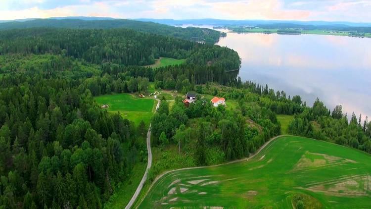
The municipality sits south of the Ranfjorden and stretches south and east toward the border with Sweden. The Nordland Line and European route E06 cross Hemnes on their way to the town of Mo i Rana about 20 kilometres (12 mi) to the northeast. The E6 highway enters Hemnes from the west through the Korgfjell Tunnel from Vefsn.
General information
This municipality was established in 1839 when the old municipality of Rana was divided into Sør-Rana and Nord-Rana, shortly after the Formannskapsdistrikt law went into effect. Soon after, in 1844, Sør-Rana was renamed Hemnes.
On 1 July 1918, the southern district of Hemnes (population: 1,369) was separated to become the new municipality of Korgen. This left Hemnes with 3,567 residents. A few months later on 1 January 1919, the eastern area of Bardal (population: 4) was transferred to Nesna. Then on 1 July 1929, Hemnes was split into three municipalities: Sør-Rana, Elsfjord, and Hemnes. After this the municipality of Hemnes only consisted of the village of Hemnesberget and the area immediately around it (population: 1,077). On 1 January 1964, the municipalities of Korgen, Hemnes, the extreme northern part of Hattfjelldal, and the southern part of Sør-Rana were all merged to form a new, larger municipality of Hemnes.
Name
The municipality (originally the parish) is named after the old Hemnes farm (Old Norse: Heimnes, now called Hemnesberget), since the first church was built there. The first element is heimr which means "home" (here in the sense of being "closest to home") and the last element is nes which means "headland", referring to the peninsula on which the farm is located.
Coat-of-arms
The coat-of-arms is from modern times; they were granted on 4 April 1986. The arms show a boat gold clamp on a blue background. Shipbuilding has long been a tradition in the municipality and an element to symbolize shipbuilding was considered appropriate. The symbol chosen is a kind of clamp used to keep the wooden flanks of the ships together, and the blue background represents the ocean.
Churches
The Church of Norway has three parishes (sokn) within the municipality of Hemnes. It is part of the Indre Helgeland deanery in the Diocese of Sør-Hålogaland.
Second World War
As part of their drive on Northern Norway, a detachment of three hundred German soldiers landed at Hemnes from the captured Norwegian coastal steamer SS Nordnorge on 10 May 1940 and captured the municipality from a platoon of British soldiers from No. 1 Independent Company, despite a spirited defence in the streets of Hemnesberget. A Royal Navy task force consisting of the anti-aircraft cruiser Calcutta and destroyer Zulu sank the former Norwegian steamer and shelled the German forces in the town, but were unable to dislodge the German landing force.
A Norwegian Army detachment attempted a counterattack against the German's positions, but was driven back. The town was again bombarded on 12 May by a passing Royal Navy force without significant effect, leaving Hemnes in German control for the rest of the war.
Government
All municipalities in Norway, including Hemnes, are responsible for primary education (through 10th grade), outpatient health services, senior citizen services, unemployment and other social services, zoning, economic development, and municipal roads. The municipality is governed by a municipal council of elected representatives, which in turn elect a mayor.
Municipal council
The municipal council (Kommunestyre) of Hemnes is made up of 23 representatives that are elected to every four years. Currently, the party breakdown is as follows:
Geography
The lake Røssvatnet (Southern Sami: Reevhtse) is a lake and reservoir lying partially in the southern part of Hemnes. It has been the site of human occupation since the Stone Age. Its area of 219 square kilometres (85 sq mi) makes it the second largest lake in Norway by surface area. Other lakes include Bleikvatnet, Grasvatnet, Stormålvatnet, and Stormyrbassenget.
The Okstindan mountain range is located in Hemnes, including the mountain Oksskolten. The large Okstindbreen glacier sits atop the mountain range.