
River system Elbe Source Eichsfeld | Length 65 km Country Germany | |
 | ||
Location Thuringia, Saxony-Anhalt, Germany Main source Source region: Eichsfeld River mouth Unstrut near Kalbsrieth Progression Unstrut → Saale → Elbe → North Sea Waterbodies Reservoirs: Kelbra Reservoir | ||
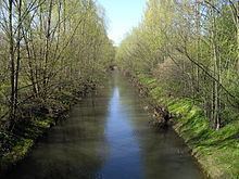
The Helme is river in central Germany that is about 65 kilometres (40 mi) long and which forms a left-hand, western tributary of the Unstrut in the states of Thuringia and Saxony-Anhalt.
Contents
Map of Helme, Germany
Course
The river rises in Thuringia south of the Harz mountains in the district of Eichsfeld. Its source lies amongst the northern foothills of the Ohm Hills between Weißenborn-Lüderode and Stöckey by the Helmspring. The Helme flows eastwards through the municipalities of Hohenstein and Werther to Nordhausen. Near Heringen the river is joined by the waters of the Zorge from the Harz. Northwest of the Kyffhäuser hills it is impounded into a reservoir and a flood retention basin by the Kelbra Dam in the Goldene Aue. From there the Helme – now in the state of Saxony-Anhalt – continues eastwards flowing through Roßla towards Allstedt, where it then swings south and enters Thuringia again. Near Kalbsrieth, southeast of Artern, it discharges into the Unstrut.