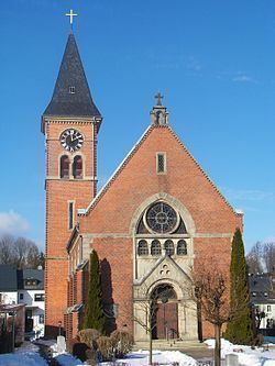
Admin. region Oberfranken Elevation 616 m (2,021 ft) Area 58.66 km² Local time Thursday 11:09 AM | District Hof Time zone CET/CEST (UTC+1/+2) Population 9,091 (31 Dec 2008) Postal code 95233 | |
 | ||
Weather 6°C, Wind SW at 11 km/h, 76% Humidity | ||
Helmbrechts is a town in the district of Hof, in Bavaria, Germany. It is situated on the Southern edge of the Frankenwald, 20 km southwest of Hof.
Contents
Map of Helmbrechts, Germany
The first documented mention of Helmbrechts dates back to 1232. Township was granted to Helmbrechts by Count Friedrich V. of Nürnberg in the year 1422. Helmbrechts has been in Bavarian rule since 1810. During World War II, Helmbrechts was the host of a sub-camp from Flossenbürg (see Helmbrechts concentration camp).
The city districts
With the local government reorganization in 1972, the following villages were merged to Helmbrechts' district:
Weavers‘ cottage
Kleinschwarzenbach is a small village belonging to Helmbrechts with a long tradition in weaving. One of the weavers‘ cottages of pre-industrial times could be visited.
References
Helmbrechts Wikipedia(Text) CC BY-SA
