
Country Denmark Population 11,355 (2014) | Municipality Hedensted Local time Sunday 4:45 AM | |
 | ||
Region Central Denmark (Midtjylland) Time zone Central Europe Time (UTC+1) Weather -1°C, Wind SW at 6 km/h, 91% Humidity | ||
Ny rema 1000 butik bnet i hedensted
Hedensted is a Danish town in Region Midtjylland and the seat of Hedensted Municipality. Its population, including its northern neighbouring town Løsning, is 11,355. The municipality as a whole has a population of 45,715 (1 January 2014).
Contents
- Ny rema 1000 butik bnet i hedensted
- Map of 8722 Hedensted Denmark
- 5 eren i hedensted
- History
- Geography
- References
Map of 8722 Hedensted, Denmark
5 eren i hedensted
History
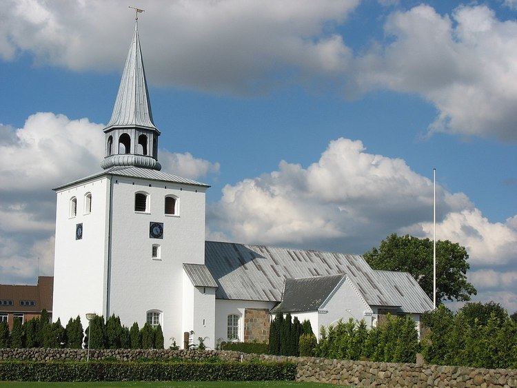
The oldest and one of the most important buildings in the town is the local church (Hedensted Kirke), built around 1175. It is especially noted for its early murals showing Christ, St. Peter, and St. Paul.
Hedensted had the benefits of a railway station until it was closed down in the 1970s. However, in 2005 a new station was opened on roughly the same spot.
Like many other Danish towns, Hedensted was expanded with large residential areas around the original town centre. Later, industrial parks followed south and west of the town.
Geography
Hedensted is located midway between the larger towns of Horsens and Vejle. East of Hedensted, by the coast, lies the town of Juelsminde which in 2007 became a part of the municipality of Hedensted.