
Population 2,225 (2001) Civil parish Heaton-with-Oxcliffe Dialling code 01524 | OS grid reference SD443603 Sovereign state United Kingdom | |
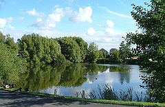 | ||
Heaton-with-Oxcliffe is a civil parish situated near the River Lune. it is in the City of Lancaster and the English county of Lancashire. The parish contains the villages of Heaton, Oxcliffe Hill, plus the area around Salt Ayre, and had a population of 2,225 recorded in the 2001 census,
Contents
Map of Heaton, Morecambe, UK
The Golden Ball Inn
The area around the Golden Ball Inn, in Oxcliffe, is locally known as Snatchems, as it was once a place that press gangs frequented. The front door of the Inn is 6 feet (1.8 m) above the road, as the road frequently floods on a spring tide, the lower car park displaying a white line on the wall, about 5 feet (1.5 m) above the ground, showing the highest level that the Lune reached during a major flood in 1967.
References
Heaton-with-Oxcliffe Wikipedia(Text) CC BY-SA