
Elevation 100 m Population 1,983 (2006) | Area 7.375 km² Local time Sunday 12:02 PM | |
 | ||
Weather 15°C, Wind NE at 10 km/h, 72% Humidity Points of interest Rapaki Track, Castle Rock Reserve, Christchurch Gondola | ||
Tandem paragliding flight heathcote valley christchurch new zealand
Heathcote Valley is a suburb of Christchurch, New Zealand.
Contents
- Tandem paragliding flight heathcote valley christchurch new zealand
- Map of Heathcote Valley Christchurch New Zealand
- Location
- History
- Relation to Heathcote River
- Naming
- References
Map of Heathcote Valley, Christchurch, New Zealand
Location
The suburb is dominated by the approaches to the Lyttelton road tunnel, a major arterial that passes through the Port Hills. The road is part of the State Highway 74 network. The Main South Railway line passes through the suburb, before entering the Lyttelton rail tunnel that connects with the port of Lyttelton.
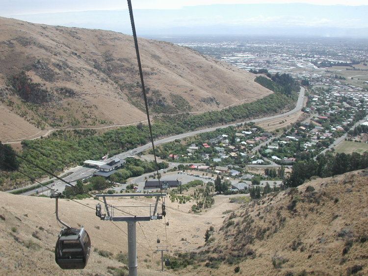
The suburb is nestled at the foot of the steep volcanic crags that form the northern edge of the hills, some 8 kilometres (5 mi) southeast of the city centre. Heathcote Valley is also the starting point of the Christchurch Gondola, which goes up to Mount Cavendish on the Port Hills. The Gondola officially opened on 24 November 1992.
History
Heathcote Valley has a long history of malting, the latest being the Canterbury Malting Company. The disused Maltworks, which closed in 1999, dominate the skyline. The distinctive Maltworks tower along with the rest of the remaining buildings were demolished in February 2012 to make way for residential developments.
Ex-All Blach Walter Argus bought a market garden in Heathcote Valley in 1949, so did not tour South Africa with the team.
Relation to Heathcote River
Despite its name, Heathcote Valley is situated some two kilometres south of the Heathcote River, which does not flow through the suburb but rather flows east across a wide plain.
Naming
The suburb is named after Sir William Heathcote, secretary of the Canterbury Association.