
PIN 844505 Elevation 43 m Area code 06227 | Time zone IST (UTC+5:30) Telephone code 06227 Local time Saturday 7:13 PM | |
 | ||
Weather 25°C, Wind W at 6 km/h, 35% Humidity | ||
Kushwaha chowk jandaha vaishali
Location
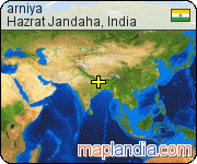
National Highway 103 passes through kargil chowk Jandaha. kargil chowk Jandaha is located in Vaishali District of Bihar. It lies near the district’s border with Samastipur District. It is around 30 km east of Hajipur and lies near Jandaha.
Patna Airport is the nearest airport. Desari Railway Station is the nearest railhead.
Transport
Nearst Railway stationHajipur - 30km, Patori, Muzaffarpur, and Samastipur.
Patna Airport - 55 km. Patna airport is well connected through road. Buses, taxis, auto available 24*7.
Jandaha is connected to other parts of India through national and state highways. The major highways are:
References
Hazrat Jandaha Wikipedia(Text) CC BY-SA