
 | ||
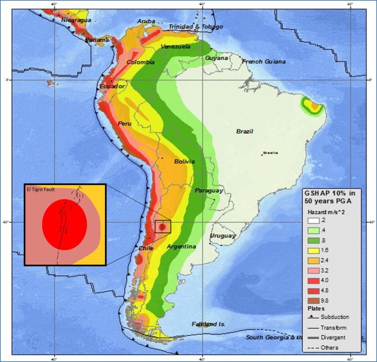
A hazard map is a Map that highlights areas that are affected by or vulnerable to a particular hazard. They are typically created for natural hazards, such as earthquakes, volcanoes, landslides, flooding and tsunamis. Hazard maps help prevent serious damage and deaths.
Uses of Hazard Maps
Hazard maps are created and used in conjunction with several natural disasters. Different hazard maps have different uses. For instance, the hazard map created by the US Geological Survey is used by American insurance agencies in order to properly adjust insurance for people living in hazardous areas. Hazard maps created for flooding are also used in insurance rate adjustments. Hazard maps can also be useful in determining the risks of living in a certain area. Hazard maps can help people become aware of the dangers they might face from natural disasters in a specific area.