
OS grid reference ST340004 Sovereign state United Kingdom Local time Saturday 8:18 AM | Civil parish Hawkchurch Postcode district EX13 Dialling code 01297 | |
 | ||
Weather 11°C, Wind W at 26 km/h, 94% Humidity | ||
Hawkchurch is a village and civil parish in Devon, England, 3 miles north east of Axminster on the border of Devon and Dorset, and about 6 miles south of Somerset. It is 4 miles north of the tourist and fishing village of Lyme Regis.
Map of Hawkchurch, Axminster, UK
The parish was in Dorset until 1896. The Parish is surrounded by Sedgecroft, Brimley and Courshay.
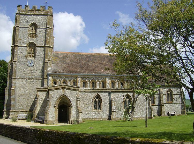
The parish church of St. John the Baptist dates from Saxon times, however, the building was heavily restored in 1862.
In 1878 the Rev. John Going became rector to the parish and planted rose trees on the walls of every cottage, which gave Hawkchurch its title "The Village of Roses".
The village pub, "The Old Inn", is a traditional coaching house, and a hostelry has been on the site since 1543.
The Manor House, Wyld Court, dates from 1593. It was built for Robert Moore, whose coat of arms is inscribed above the door. An earlier mediaeval house on the site belonged to Cerne Abbey, prior to the dissolution of the Monasteries. It is a Grade II* listed building.
In 1870-1872,Hawkchurch was described as:
a village and a parish in the district of Axminster and county of Dorset. The village stands near the boundary with Devon, the river Axe, and the Yeovil and Exeter railway, 3¼ miles NE by E of Axminster; and has a post office under Axminster.
According to the 2011 Census there were 271 males and 282 females living in the parish.