
Time zone EET (UTC+2) Licence plate 10 Elevation 44 m Local time Saturday 9:39 AM | Region Aegean Postal code 10xxx Website www.havran.bel.tr Area 543 km² Area code 266 | |
 | ||
Weather 4°C, Wind NE at 11 km/h, 76% Humidity | ||
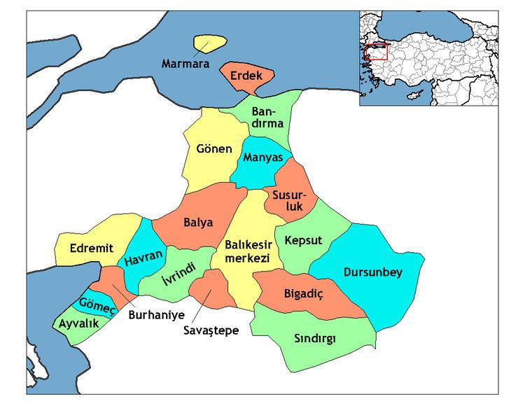
Havran is a town and county of Balıkesir Province in the Marmara region of Turkey. According to the 2010 census, the population of the county is 28,050 of which 10,766 live in the town of Havran.
Map of Havran, 10560 Havran%2FBal%C4%B1kesir Province, Turkey
The county covers an area of 543 km2 (210 sq mi), and the town lies at an elevation of 44 m (144 ft).
The county has traditionally produced Cheese and a fruit drink called Şerbet. Until the 1920 the population was mix of Turkish, Greek, and Tatar (refugees) with small numbers of Jews and Armenians.
References
Havran, Balıkesir Wikipedia(Text) CC BY-SA