
- location Lake Britton Elevation 1,043 m Zip code 96040 Local time Friday 4:47 PM | - average 472.2 cu ft/s (13 m/s) Area 130 km² Population 309 (2010) Area code 530 | |
 | ||
- location Dersch Meadows, Lassen Volcanic National Park Weather 21°C, Wind SW at 11 km/h, 34% Humidity | ||
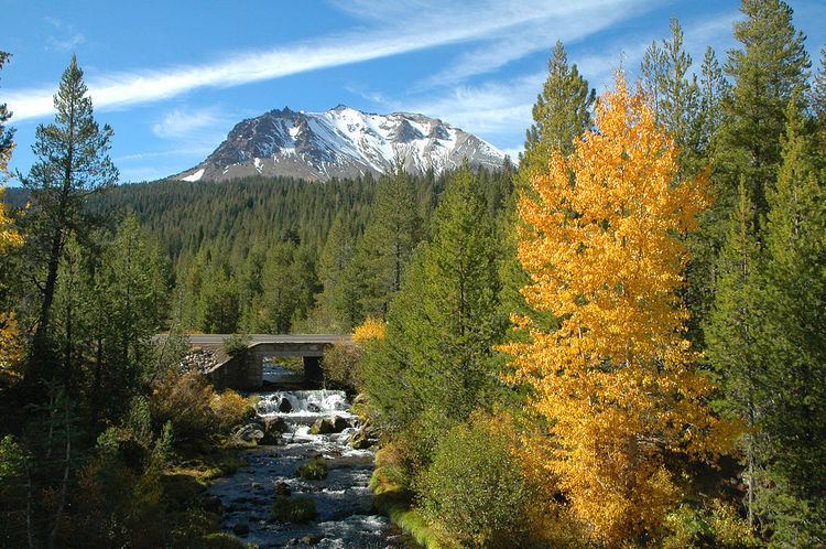
Hat Creek is a 48.7-mile-long (78.4 km) stream and tributary of the Pit River, located in Shasta County of northern California.
Contents
Map of Hat Creek, CA 96040, USA
The creek rises in two forks on the eastern slopes of Lassen Peak in Lassen Volcanic National Park, and flows northward through Lassen National Forest to its mouth at Lake Britton near Burney, California.
Hat Creek is so named because a surveyor lost his hat there.
Wild Trout WaterwayEdit
The lower three and a half miles of the creek has been designated by the California Department of Fish and Game as a "Wild Trout Waterway," with restrictive catch limits. This area has a similar geology to the chalk streams of southern England, and is considered a classic trout stream. The trout population is made of wild rainbow and brown trout of up to 20 inches (510 mm) in length.
TownsEdit
The main towns along Hat Creek are Hat Creek and Old Station, which is closer to Lassen Park. The Hat Creek Radio Observatory is located near the town of Hat Creek.
During the May 19, 1915, eruption of Mount Lassen, a lahar or mudflow swept down Hat Creek and neighboring Lost Creek.