
Highest elevation 290 m (950 ft) Elevation 290 m | Lowest elevation 0 m (0 ft) Area 3.12 km² | |
 | ||
Similar Kintai Bridge, Mount Jakuchi, Kasatka Bay, Yamato Museum, Ninoshima | ||
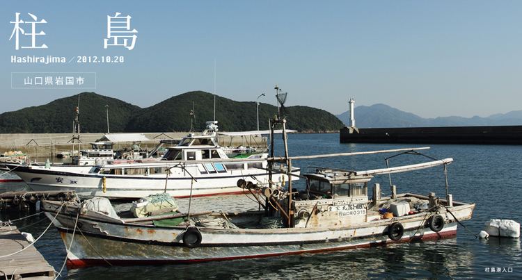
Hashira Island (柱島, Hashira-jima) is an island in southern Hiroshima Bay of the Inland Sea, Yamaguchi Prefecture, Japan. Located 26 kilometres (16 mi) kilometers southeast of Iwakuni, it is part of the Kutsuna Islands within the Bōyo Islands group. The island covers 3.12 square kilometres (1.20 sq mi) and as of 2013 had a population of 184 residents.
Map of Hashira Island, Hashirajima, Iwakuni, Yamaguchi Prefecture 740-0051, Japan
The highest point on the island is Mt. Kinzō. Economic activity on the island consists of fishing and cultivation of vegetables and citrus fruit. Hashirajima is connected to the port at Iwakuni Mondays through Saturdays by a high speed ferry.
The island is best known for its association in World War II with the surrounding Hashirajima Anchoring Area. Located 30–40 km south of the naval base at Kure, Hiroshima, warships of the Imperial Japanese Navy that did not need dock repairs would anchor at Hashirajima and it was also used as a staging area before fleet departures. It was also the site of the loss of the IJN battleship Mutsu, which suffered an internal explosion and sank there.