
Area of Search Hereford And Worcester Interest Biological/Geological Phone +44 1905 766493 | Grid reference SO 824707 Notification 1955, 1986 | |
 | ||
Hours Open today · Open 24 hoursFridayOpen 24 hoursSaturdayOpen 24 hoursSundayOpen 24 hoursMondayOpen 24 hoursTuesdayOpen 24 hoursWednesdayOpen 24 hoursThursdayOpen 24 hours Similar Hartlebury Castle, Kyre Park, Treasure Island, Gadfield Elm Chapel, Bewdley Museum | ||
Hartlebury common from the air
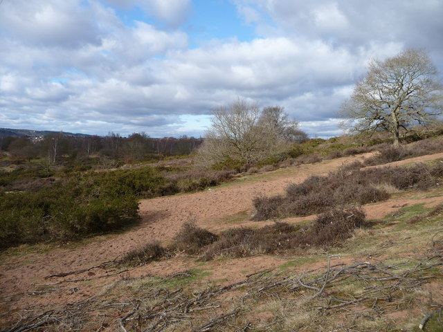
Hartlebury Common is an area of lowland heath in north Worcestershire, England, situated just outside the town of Stourport-on-Severn. Hartlebury Common and Hillditch Coppice are a biological and geological Site of Special Scientific Interest which covers an area of 90.2 hectares (229 acres). The common supports many varieties of wild plants and insects, especially butterflies and moths. Hartlebury Common and Hillditch Pool are a Local Nature Reserve.
Contents
The common is easily accessed from several small car parks and popular with horse riders, walkers, joggers and naturalists. There are waymarked trails for walkers and horse riders such as the heather trail and horse route.
Hartlebury common
Location
The site lies on southeast edge of Stourport-on-Severn. It can be accessed is via the Wilden Top car park on the B1495 Stourport to Hartlebury Road, the Lower Poollands car park off Titton Lane and three car parks on the A4025 Stourport to Worcester Road.
Toponymy
The name Hartlebury is derived from the Anglo-Saxon Heoertlabyrig meaning "Hill of the Deer".
Geology
Hartlebury Common lies on Quaternary wind-blown sand which covers two river terraces of the River Severn overlying Bunter and Keuper Sandstone. It is situated within the Abberley and Malvern Hills Geopark which was launched in 2004. Falling within the counties of Herefordshire, Gloucestershire, Shropshire and Worcestershire the Geopark covers 3,240 km2 (1,250 square miles). The geological and geomorphological significance of the area has been recognised for many years with 13 Sites of Special Scientific Interest (SSSI) and 179 Local Geological Sites (LGS) present. The Abberley and Malvern Hills Geopark is one of only seven geoparks in the UK.
Archaeology
Hartlebury Common supports a range of archaeological remains including stone revetted banks, historic trackways (or 'holloways'), post-medieval quarries and pools that contain paleoenvironmental deposits and the site of a 19th-century rifle range. There is also evidence of a large circular embanked enclosure on the common which may have been a signalling post, hunting lodge, small ringwork castle or religious site. Mesolithic and Neolithic artefacts have also been found at the site.