
Population 1,879 (2011) Local time Friday 12:43 PM | OS grid reference SK493807 Dialling code 01909 | |
 | ||
Weather 8°C, Wind SW at 31 km/h, 78% Humidity | ||
Harthill is a village in the Metropolitan Borough of Rotherham (part of South Yorkshire, England), on the border with Derbyshire. It lies between Killamarsh and Thorpe Salvin, and is located at approximately 53°19′10″N 1°15′30″W, at an elevation of around 110 metres above sea level. In the 2001 census, the civil parish of Harthill with Woodall had a population of 1,909, reducing slightly to 1,879 at the 2011 Census.
Map of Harthill, UK
Harthill is traditionally an agricultural village, although there is also a history of quarrying whetstones for use in knife-sharpening.
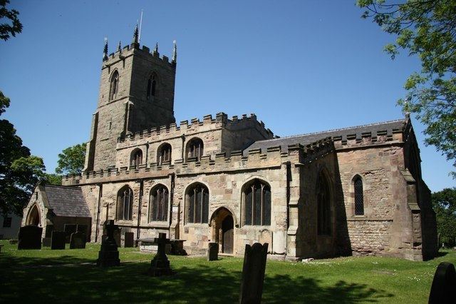
The parish church of All Hallows dates from 1085, when it was commissioned by William de Warenne. The tower is 14th century. The Dukes of Leeds, major landowners in the area, and their families are interred in the crypt.
Harthill has two public houses: the Beehive and the Blue Bell.
Harthill is the principal village in the civil parish of Harthill with Woodall. The parish also contains Harthill Reservoir which feeds the Chesterfield Canal, Nor Wood, and the hamlet of Woodall with its M1 motorway service station.