
Airport type Public 18/36 6,502 Code CDH Phone +1 870-836-6436 | Owner City of Camden Elevation AMSL 130 ft / 39 m Address Camden, AR 71711, USA Elevation 39 m | |
 | ||
Similar Camden Regional Airport, Airport Inn, Southern Arkansas University, Camden Fairview High Sch, Lockheed Martin | ||
Central mississippi light flyers april meeting at harrell field
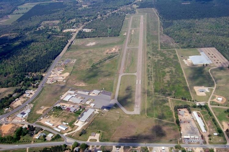
Harrell Field (IATA: CDH, ICAO: KCDH, FAA LID: CDH) is a public use airport located 5 nautical miles (9 km; 6 mi) northeast of the central business district of Camden, a city in Ouachita County, Arkansas, United States. It is also known as Camden Regional Airport or Camden Municipal Airport. This airport is included in the FAA's National Plan of Integrated Airport Systems for 2009–2013, which categorizes it as a general aviation facility.
Contents
- Central mississippi light flyers april meeting at harrell field
- Leg 2 flying up to pisgah harrell field
- History
- References
Leg 2 flying up to pisgah harrell field
History
Opened in August 1942 with 4,800 turf runway. Began training United States Army Air Corps flying cadets under contract to Wiggings-Marden Aero Corp. Assigned to United States Army Air Forces Gulf Coast Training Center (later Central Flying Training Command) as a primary (level 1) pilot training airfield. It had two local auxiliary airfields for emergency and overflow landings. Flying training was performed with Fairchild PT-19s and Fairchild PT-23s as the primary trainers. Also had several PT-17 Stearmans and a few P-40 Warhawks assigned.
Inactivated on 15 April 1944 with the drawdown of AAFTC's pilot training program. Declared surplus and turned over to the Army Corps of Engineers on 30 September 1945. Eventually discharged to the War Assets Administration (WAA) and became a civil airport. It appears to have closed after the war about 1951, later reopened.