
Time zone PST (UTC+5) Number of Union councils 45 Area code 0995 | Calling code 0995 Elevation 520 m Local time Friday 12:42 AM | |
 | ||
Weather 12°C, Wind E at 11 km/h, 71% Humidity University Sir Syed Model School and College Neighborhoods Mohallah Ferozpura, Main bazar, Mohallah Khoo, Mohallah Darwesh, Mohallah Malik Pura, Mohallah Qadeem | ||
Haripur hazara pakistan
Haripur (Urdu/Hindkoہری پور ) is the main city of the Haripur District in Hazara, Khyber Pukhtunkhwa in Pakistan, with Swabi and Buner to the west, some 65 km (40 mi) north of Islamabad and 35 km (22 mi) south of Abbottabad. It is located in a hilly plain area at an altitude of 520 m (1,706 ft). The city lies on the Karakoram Highway (N35). Many castes and tribes are living at Haripur including the, Tanolis, Khan, Abbasi, Gakhars, Gujjars, Arain, Karlal, Qazi/Awan, Jadoon, Tareen, Sulemani, .
Contents
- Haripur hazara pakistan
- Map of Haripur Pakistan
- Haripur hazara one of the beautiful cities of pakistan
- History
- Notable personalities
- Languages
- Geographical features
- Climate
- References
Map of Haripur, Pakistan
Haripur hazara one of the beautiful cities of pakistan
History
Haripur was founded by the Sikh general Hari Singh Nalwa in 1822 and became the headquarters of Hazara until 1853. Hari Singh Nalwa was appointed by Maharaja Ranjit Singh as the second Nazim of Hazara after the first Nazim Amar Singh Majithia was killed by the local populace at Nara.
Haripur was built as a fortress surrounded by a wall which was 4 yards (3.7 m) thick and 16 yards (15 m) high and had only four openings. That fort later became the city police station and local government offices.
Drinking water was provided by digging a tank. Many small drainages were dug to carry sullage water. A small river, the river Dore, passes through the city, feeding the Tarbela Dam.
Baron Hugel visited the town on 23 December 1835, and he found it humming with activity. The municipality was constituted in 1867.
An obelisk marks the grave of Colonel Canara, a European officer of the Sikh Artillery, who fell in 1848 defending his guns single-handed against the insurgents under Chattar Singh.
In 1851, the 4th (Hazara) Mountain Battery was raised at Haripur from Hazara gunners, who were trained by Majtt, a British officer and first deputy commissioner of Hazara, in order to defend the district. The Hazaras embarked on many campaigns throughout the province.
The population in 1901 was 5,578 and the income and expenditure during the ten years ending 1902–3 averaged Rs. 17,800. In 1903-4 the income and expenditure were Rs. 19,100 and Rs. 20,000 respectively.
Notable personalities
Languages
Geographical features
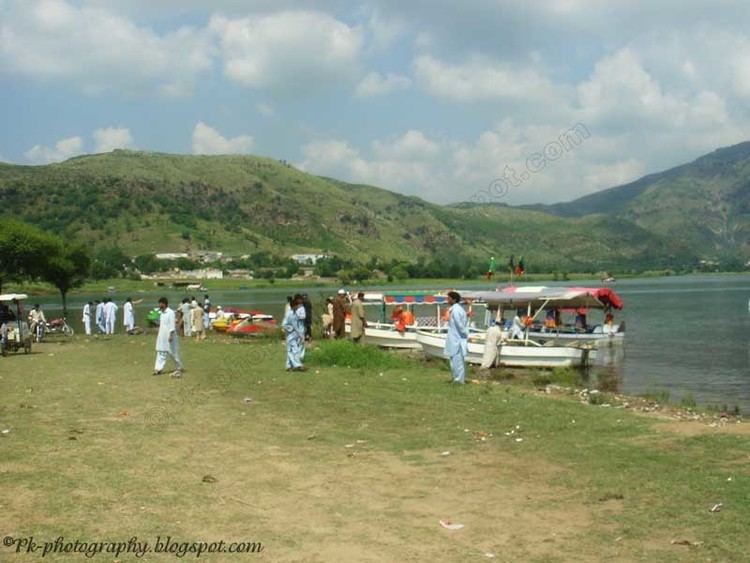
Haripur is a green valley, rich in fruits and vegetables, serves as the base market for the mountainous cities of Abbottabad and Mansehra and the rest of Hazara Division. Haripur is famous for its guavas (Urdu: امرود). Khanpur, one of the main areas of Haripur, is known for red blood oranges and khanpur lake. Red blood oranges are very famous all over Pakistan; in fact, they are also exported to other countries.
Several miles to the south of Haripur lies the ancient Buddhist university town of Taxila. To the north is the world's largest rock-filled dam, the Tarbela Dam, the bulwark of Pakistan's power generation and irrigation system. Also to the south lies the picturesque Khanpur Dam, which supplies drinking water to Islamabad and Rawalpindi.
The industrial area of Hattar lies close to Haripur. Another major industrial complex lying at the outskirts of the city is the Telephone Industries of Pakistan (TIP), the biggest telephone factory in Asia. Located next to TIP is the National Radio Telecommunication Corporation (NRTC).
Haripur has the University of Haripur and campus of Allama Iqbal Open University, and a campus of the Hazara University, Dhodial Mansehra. T & T colony is one of the most planned colony in the area which was designed by a prestigious company of Germany, Siemens, back in 1950's.
Climate
Characterized by relatively high temperatures and evenly distributed precipitation throughout the year. This climate type is found on the eastern sides of the continents between 20° and 35° N and S latitude. The Köppen Climate Classification subtype for this climate is "Cfa" (Humid Subtropical Climate).