
Country SomaliaSomaliland Area 25 km2 | Region Woqooyi Galbeed Mayor Abdurrahman Mahmoud Aidiid | |
Colleges and Universities University of Hargeisa | ||
Hargeisa (Somali: , Arabic: ?, "little Harar") is a city in the northwestern Woqooyi Galbeed province of Somalia. It is the second-largest city in the country after Mogadishu, the national capital. Hargeisa serves as the capital of Somaliland, a self-declared republic that is internationally recognized as an autonomous region of Somalia.
Contents
Map of Hargeisa
During the Middle Ages, Hargeisa was part of the Adal Sultanates domain. The city later succeeded Berbera as the capital of the British Somaliland protectorate in 1941. In 1960, the protectorate gained independence and united as scheduled days later with the Trust Territory of Somaliland (the former Italian Somaliland) to form the Somali Republic (Somalia) on July 1.
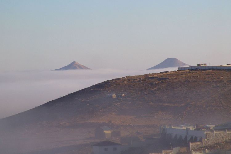
Hargeisa is situated in a valley in the Galgodon (Ogo) highlands, and sits at an elevation of 1,334 m (4,377 ft). Home to rock art from the Neolithic period, the city is also a commercial hub for precious stone-cutting, construction, retail services and importing/exporting, among other activities.
American english teachers university of hargeisa
History
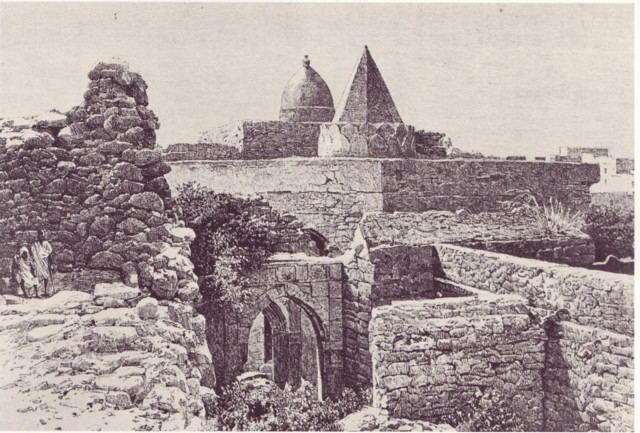
Numerous cave paintings from the Neolithic period are found in the Laas Gaal complex, on the outskirts of Hargeisa. During November and December 2002, an archaeological survey was carried out in the area by a French team of researchers. The expeditions objective was to search for rock shelters and caves containing stratified archaeological infills capable of documenting the period when production economy appeared in this part of Somalia (circa 5,000 and 2,000 BCE). During the course of the survey, the French archaeological team discovered the Laas Gaal rock art, encompassing an area of ten rock alcoves (caves). In an excellent state of preservation, the paintings show human figures with their hands raised and facing long-horned, humpless cattle.
The rock art had been known to the areas inhabitants for centuries before the French discovery. However, the existence of the site had not been broadcast to the international community. In November 2003, a mission returned to Laas Gaal and a team of experts undertook a detailed study of the paintings and their prehistoric context.
Northern Somalia in general is home to numerous such archaeological sites, with similar rock art and/or ancient edifices found at Haylaan, Qa’ableh, Qomboul and Elaayo. However, many of these old structures have yet to be properly explored, a process which would help shed further light on local history and facilitate their preservation for posterity.
Geography
Hargeisa is located in a mountainous area, in an enclosed valley of the northwestern Galgodon (Ogo) highlands. It sits at an elevation of 1,334 meters (4,377 feet) above sea level.
The city used to be surrounded by forest when it was smaller in size, but the countryside around it still has small junipers. Near Hargeisa are the fertile Sheikh and Daallo mountains, which receive large amounts of rain. South of the city is the Haud savannah (Baligubadle), which attracts many different species of wildlife to graze in the area.
Hargeisa is situated near the town of Gabiley, which serves as an agricultural center in northern Somalia. That towns Allay-Baday area produces tons of tomatoes and onions each month during the rainy season. The city of Arabsiyo is also located nearby, and is noted for its lemon production.
Due to its relative fertility and greenery, wild animals come to the Hargeisa area to either breed or graze on the grassland savannah. Fauna that can be found in rural sections of the city include the kudu, wild boars, Somali wild ass, warthogs, antelopes, Somali sheep, goats, camels, and many different types of birds. There are also a number of both public and private menageries. South of Hargeisa is a grassland savannah, which attracts many types of wildlife to the area, including lions and leopards.
Economy
Hargeisa is the financial hub to many entrepreneurial industries ranging from gem stonecutters, to construction, food processing, retail, and import and export firms.