
Population 256 (2011 census) Unitary authority Local time Thursday 1:05 PM | OS grid reference NT934046 Sovereign state United Kingdom Dialling code 01669 Post town Morpeth | |
 | ||
Weather 9°C, Wind SW at 27 km/h, 86% Humidity | ||
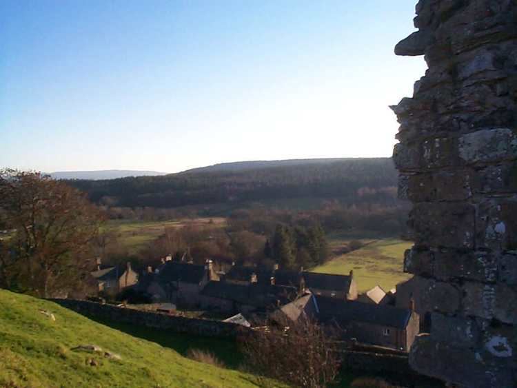
Harbottle is a village and civil parish in Northumberland, England about 10 miles (16 km) south-east of the Scottish border, in the southeastern part of the Cheviot Hills and inside Northumberland National Park. The village is the site of Harbottle Castle built by order of Henry II. Now in ruins, the castle was constructed by the Umfraville family to protect against invaders from Scotland.
Contents
Map of Harbottle, Morpeth, UK
Landmarks
Harbottle Castle is a ruinous medieval castle dated to the 12th century, situated at the west end of the village overlooking the River Coquet. It is a Scheduled Ancient Monument and a Grade I listed building.
The Drake Stone punctuates the hills surrounding Harbottle. The massive erratic sandstone boulder, believed in times past to be endowed with supernatural powers, was deposited by a glacier during the Ice Age. It has been compared to the Bowder Stone of Cumbria. Harbottle Lake is situated just behind the Drake Stone.
Harbottle has a single small public house: The Star Inn.