
 | ||
Similar | ||
discovery bangla dcoumentary youtube hangzhou bay bridge
Hangzhou Bay, or the Bay of Hangzhou (simplified Chinese: 杭州湾; traditional Chinese: 杭州灣; pinyin: Hángzhōu Wān; Hangzhou Wu: Han-tsei uae), is an inlet of the East China Sea, bordered by the province of Zhejiang and the municipality of Shanghai. The Qiantang River flows into the bay.
Contents
- discovery bangla dcoumentary youtube hangzhou bay bridge
- Map of Hangzhou Bay Haiyan Jiaxing China
- Hangzhou bay bridge in china
- References
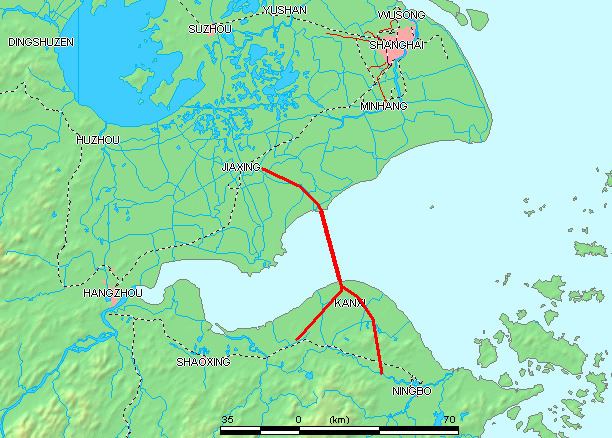
Map of Hangzhou Bay, Haiyan, Jiaxing, China
It lies south of Shanghai, and ends at the city of Hangzhou. Hangzhou Bay contains many small islands collectively called the Zhoushan Islands.
The bay is known for hosting the world's largest tidal bore, up to 9 metres (30 ft) high, and traveling up to 40 km (25 mi) per hour.
The bay is spanned by the Hangzhou Bay Bridge, which was linked up on June 14, 2007 and opened on 1 May, 2008. The then second-longest bridge in the world, it cuts the trip between eastern Zhejiang and Shanghai from 400 to 80 kilometres (250 to 50 miles).
The entire bay area is shallow at less than 15 meters depth.