
Hangul 한강대교 Revised Romanization Hangang daegyo Opened 1917 | Hanja 漢江大橋 McCune–Reischauer Han’gang taekyo | |
 | ||
Similar Dongjak Bridge, Hangang Railway Bridge, Banpo Bridge, Mapo Bridge, Wonhyo Bridge | ||
Son seungyeon i m every woman the third hangang bridge reaction review
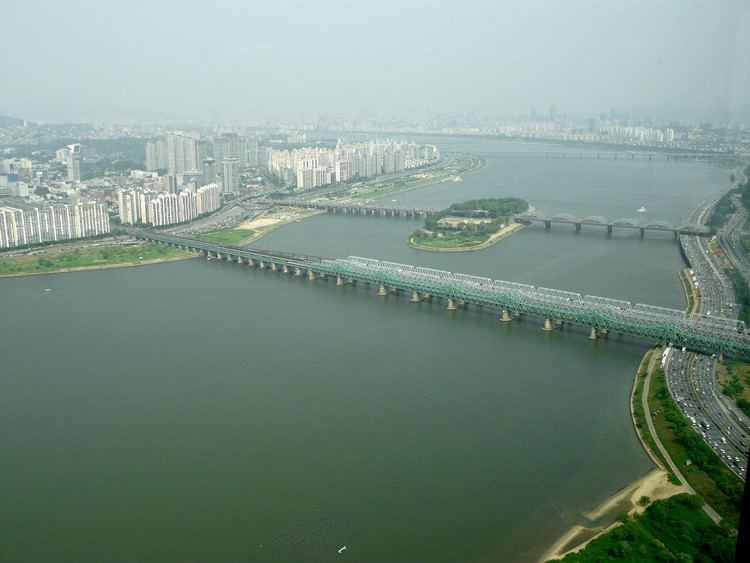
The Hangang Bridge, literally Han River bridge, crosses the Han River in Seoul, South Korea. It connects the districts of Yongsan-gu to the north and Dongjak-gu to the south, and crosses over the artificial island of Nodeulseom. The bridge carries eight lanes of traffic.
Contents
- Son seungyeon i m every woman the third hangang bridge reaction review
- Cycling in seoul seoul station to hangang bridge on fixed gear
- History
- References
The Korea Meteorological Administration considers the Han to be frozen over when the 100-meter section of water between the second and fourth posts of the southern span freezes.
Cycling in seoul seoul station to hangang bridge on fixed gear
History
Pontoon bridges were moored at the site of the modern bridge, but the Han had no fixed crossings until the nearby Hangang Railway Bridge was completed in 1900. Plans for a road bridge did not materialize until 1917, when the original footbridge (indogyo) opened. It was damaged by a flood in July 1925. In October 1935 a second span was constructed, and tram tracks added.
Shortly after the outbreak of the Korean War, South Korean troops bombed the bridge in an attempt to slow invading forces, as it was the river's solitary road crossing. The Hangang Bridge bombing killed between 500 and 1000 people, mostly civilian refugees, who had not been informed of the plans to destroy the bridge. The bridge was not fully restored until 1954.
In 1982 additional lanes were added, and it was renamed Hangang Bridge.