
Length 32 km Source Vtacnik Mountains | Basin size 178.3 km (68.8 sq mi) Source elevation 1,135 m Mouth Nitra | |
 | ||
Main source Vtacnik Mountains770 m (2,530 ft) | ||
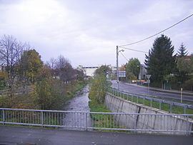
Handlovka is a 32 km long river in central Slovakia (Prievidza District). left tributary of the Nitra river. Basin area 178,3 km². Its source is in the Vtacnik Mountains, near the Biely kameň. It is located at an elevation of 244 meters above sea level. Major cities and towns situated on the Handlovka are Handlová and Prievidza. The first name of the river was Prievidza. Handlovka is also known as Handlova, Handlovka, Handlová. An approximately regular course of groundwater storage curve was disconnected for the whole period from 1993 to 1997. Average groundwater storage is varying around 370 mm per month in winter months and around 200 mm per month in summer months.
Map of Handlovka, Slovakia
References
Handlovka Wikipedia(Text) CC BY-SA