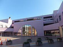
Population 179,770 (Apr 2012) | Region Kantō Area 34.24 km² | |
 | ||
Address 1-1 Mizuho, Hanamigawa-ku Chiba-shi, Chiba-ken262-8733 Website Official website of Hanamigawa-ku | ||
Hanamigawa Ward (花見川区, Hanamigawa-ku) is one of the six wards of the city of Chiba in Chiba Prefecture, Japan. As of April 2012, the ward has an estimated population of 179,770 and a population density of 5,250 persons per km². The total area is 34.24 km².
Contents
- Map of Hanamigawa Ward Chiba Chiba Prefecture Japan
- Geography
- Railroads
- Education
- Noted people from Hanamigawa Ward
- References
Map of Hanamigawa Ward, Chiba, Chiba Prefecture, Japan
Geography
Hanamigawa Ward is located inland in the northernmost part of the city of Chiba. The ward takes its name from the Hanami River, which flows through the ward.
Railroads
Education
The Chiba Korean Primary and Junior High School, a North Korea-aligned Korean international school, is located in Hamamigawa-ku.
Noted people from Hanamigawa Ward
References
Hanamigawa-ku Wikipedia(Text) CC BY-SA
