
Official name Presa Hanabanilla Purpose Water supply, power Height 46 m Catchment area 192 km² Construction began 1958 | Status Operational Opened 1961 Surface area 14.9 km² | |
 | ||
Opening date 1961; 56 years ago (1961) Similar Escambray Mountains, Parque Vidal, Che Guevara Mausoleum | ||
Cuba tourism ecotourism travel hanabanilla dam lake in escambray mountains natural reserve
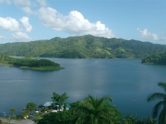
The Hanabanilla Dam is an embankment dam on the Hanabanilla River near the village of El Salto del Hanabanilla in Villa Clara Province, Cuba. The purpose of the dam is to provide water for irrigation and municipal uses and to generate hydroelectric power.
Contents
- Cuba tourism ecotourism travel hanabanilla dam lake in escambray mountains natural reserve
- Map of Hanabanilla Dam El Salto de Hanabanilla Cuba
- Overview
- References
Map of Hanabanilla Dam, El Salto de Hanabanilla, Cuba
Overview
The dam withholds a reservoir of 286,000,000 m3 (232,000 acre·ft) and the power station, located near its base, has an installed capacity of 43 MW. It is the largest hydroelectric power station in the country. Near the southern end of the reservoir is Jibacoa Dam, an auxiliary dam, which closes off one valley to create the existing large reservoir.
The dam was constructed between 1958 and 1961. The power station was commissioned in 1963. In March 2014 a rehabilitation of the power station began.