
Time zone EET (UTC+2) Elevation 98 m Local time Wednesday 7:26 PM | Postal Code 9863 Area 5.763 km² Population 408 (1 Jan 2007) | |
 | ||
Weather 7°C, Wind NW at 5 km/h, 82% Humidity | ||
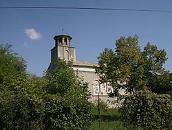
Han Krum (Bulgarian: Хан Крум) is a village in the municipality of Preslav, Shumen Province, north-eastern Bulgaria. As of 2007 it has 408 inhabitants.
Map of Han Krum, Bulgaria
Up to 1899 the village was called Chatalar and was then renamed to Tsar Krum and in 1977 to Khan Krum, after Krum who ruled Bulgaria between 803 and 814. According to some historians the Gothic episcopal see of Ulfilas was located on the site of the village. There are remains of churches dated to 4th and 5th centuries.
The old Bulgarian Palace of Omurtag, also known as Aul of Omurtag was discovered in the surroundings of the village. The palace is dated to the constructions of Khan Omurtag (814-831) based on the Chatalar Inscription.
A rock monastery is situated close to the village based on a natural cave which was later expanded.