
Country United States County Dakota FIPS code 27-26864 Elevation 302 m Population 693 (2013) Area code 651 | Time zone Central (CST) (UTC-6) GNIS feature ID 0644612 Zip code 55031 Local time Wednesday 11:28 AM | |
 | ||
Weather -4°C, Wind W at 3 km/h, 52% Humidity Area 3.522 km² (3.496 km² Land / 3 ha Water) | ||
Wat munisotaram 2557 hampton minnesota 02 14 2014 8 47
Hampton is a city in Dakota County, Minnesota, United States. The population was 689 at the 2010 census.
Contents
- Wat munisotaram 2557 hampton minnesota 02 14 2014 8 47
- Map of Hampton MN 55031 USA
- History
- Geography
- 2010 census
- 2000 census
- References
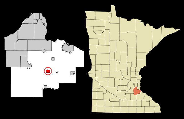
Map of Hampton, MN 55031, USA
History
A post office called Hampton has been in operation since 1856. The city took its name from Hampton Township.
Geography
According to the United States Census Bureau, the city has a total area of 1.36 square miles (3.52 km2), of which 1.35 square miles (3.50 km2) is land and 0.01 square miles (0.03 km2) is water. U.S. Highway 52; and State Highways 50 and 56 are three of the main routes in the community.
2010 census
As of the census of 2010, there were 689 people, 245 households, and 175 families residing in the city. The population density was 510.4 inhabitants per square mile (197.1/km2). There were 268 housing units at an average density of 198.5 per square mile (76.6/km2). The racial makeup of the city was 95.6% White, 1.0% African American, 0.3% Native American, 0.6% Asian, 0.4% from other races, and 2.0% from two or more races. Hispanic or Latino of any race were 2.3% of the population.
There were 245 households of which 41.6% had children under the age of 18 living with them, 58.0% were married couples living together, 7.8% had a female householder with no husband present, 5.7% had a male householder with no wife present, and 28.6% were non-families. 19.6% of all households were made up of individuals and 5.8% had someone living alone who was 65 years of age or older. The average household size was 2.81 and the average family size was 3.27.
The median age in the city was 30.6 years. 29.9% of residents were under the age of 18; 8.7% were between the ages of 18 and 24; 35.1% were from 25 to 44; 20.4% were from 45 to 64; and 5.8% were 65 years of age or older. The gender makeup of the city was 53.4% male and 46.6% female.
2000 census
As of the census of 2000, there were 434 people, 156 households, and 109 families residing in the city. The population density was 323.2 people per square mile (125.1/km²). There were 159 housing units at an average density of 118.4 per square mile (45.8/km²). The racial makeup of the city was 98.85% White, 0.23% African American, 0.23% from other races, and 0.69% from two or more races. Hispanic or Latino of any race were 0.92% of the population.
There were 156 households out of which 39.7% had children under the age of 18 living with them, 58.3% were married couples living together, 5.8% had a female householder with no husband present, and 30.1% were non-families. 23.1% of all households were made up of individuals and 10.3% had someone living alone who was 65 years of age or older. The average household size was 2.78 and the average family size was 3.36.
In the city, the population was spread out with 33.6% under the age of 18, 6.9% from 18 to 24, 35.9% from 25 to 44, 13.8% from 45 to 64, and 9.7% who were 65 years of age or older. The median age was 31 years. For every 100 females there were 99.1 males. For every 100 females age 18 and over, there were 104.3 males.
The median income for a household in the city was $53,438, and the median income for a family was $56,528. Males had a median income of $41,786 versus $26,172 for females. The per capita income for the city was $17,121. About 3.2% of families and 5.8% of the population were below the poverty line, including 5.7% of those under age 18 and 17.6% of those age 65 or over.