
Administrative division 5 Website Official website Tehsil 5 | Tehsils 5 Area 1,118 km² | |
 | ||
Colleges and Universities National Institute of Technology, Hamirpur, Himachal Pradesh Technical University | ||
Hamirpur district (Hindi: हमीरपुर जिला) is one of the 12 districts of the state of Himachal Pradesh, India. The headquarters of the district is in the Hamirpur town. The district occupies an area of 1,118 km². It is smallest district of Himachal pradesh. It is also known as Martyr's Land(Veer Bhumi).
Contents
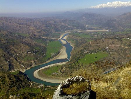
Map of Hamirpur, Himachal Pradesh
It is most educated District of Himachal and has highest density of roads amongst all districts of India.
History
Carved out from the Kangra district in 1972, the district is closely associated with the Katoch dynasty. It was the part of old Jalandhar-Trigarta empire. Panin referred to the people of this kingdom as great warriors and fighters. Even today Army is the largest employer for Hamirpuris, who form large bulks of Dogra Regiment, Jammu and Kashmir Rifles regiment as well as Hodson's Horse and Scinde Horse. In addition to their repute for being brave and professional soldiers they are well known for the hardiness characteristic of hill people thus earning the name VeerBhumi for Hamirpur as rest of Himachal calls itself Dev Bhumi.
The Katoch dynasty predominated during the period of Raja Hamir Chand who ruled from 1700 to 1740. It was Raja Hamir Chand who built the fort at Hamirpur and the present town derived its name from this ruler. <gallery>
Geography
Hamirpur District is situated between 31°25′N and 31°52′N and between 76°18′E and 76°44′E. Situated at an altitude of 785 meters, Hamirpur is the district headquarters. It shares borders with the neighbouring districts of Mandi to North,Bilaspur to South and South West, Una to West and Kangra to North West. River Beas separates Hamirpur from Kangra and is a Parent river to two of tributaries,namely Maan Khud and Kunah Khad flowing across either sides of Hamirpur district, to the adjacent Satluj. Hamirpur district has considerable amount of Pine forests. Hamirpur is also a home to mango trees.
Climate
It is not a typical "Hilly & Chilly" type of climate in district Hamirpur, as it is closer to the plains. During winter, the climate is cold but pleasant when woollens are required. During summer the temperature is hot and cottons are recommended. Temperature does sometimes cross the 44 degree Celsius mark in summers. In January 2012, some parts of Hamirpur district received moderate snowfall after 44 years.
Divisions
The district comprises 4 sub-divisions: Hamirpur, Barsar, Nadaun and Bhoranj. Hamirpur sub-division consists 2 tehsils: Hamirpur and Sujanpur. Barsar, Nadaun and Bhoranj sub-divisions comprise only one tehsil: Barsar, Nadaun and Bhoranj respectively. It looks like that himachal pradesh police is more active and responsible, taking sound action against anti socialists in remote villages of the state.
There are five Vidhan Sabha constituencies in this district: Barsar, Hamirpur, Sujanpur, Nadaun and Bhoranj. All of these are part of the Hamirpur Lok Sabha constituency.
Demography
According to the 2011 census, Hamirpur district has a population of 454,768, roughly equal to the nation of Malta. This gives it a ranking of 550th in India (out of a total of 640). The district has a population density of 407 inhabitants per square kilometre (1,050/sq mi). Its population growth rate over the decade 2001–2011 was 10.19%. Hamirpur has a sex ratio of 1095 females for every 1000 males, and a literacy rate of 88.15%.