
Country Canada Region Qikiqtaaluk Region Settled 1953 Elevation 8 m Population 848 (2016) Number of airports 1 | Territory Nunavut Electoral district Amittuq Time zone EST (UTC-5) Area 16.82 km² Local time Wednesday 12:53 AM | |
 | ||
Weather -16°C, Wind SW at 14 km/h, 83% Humidity | ||
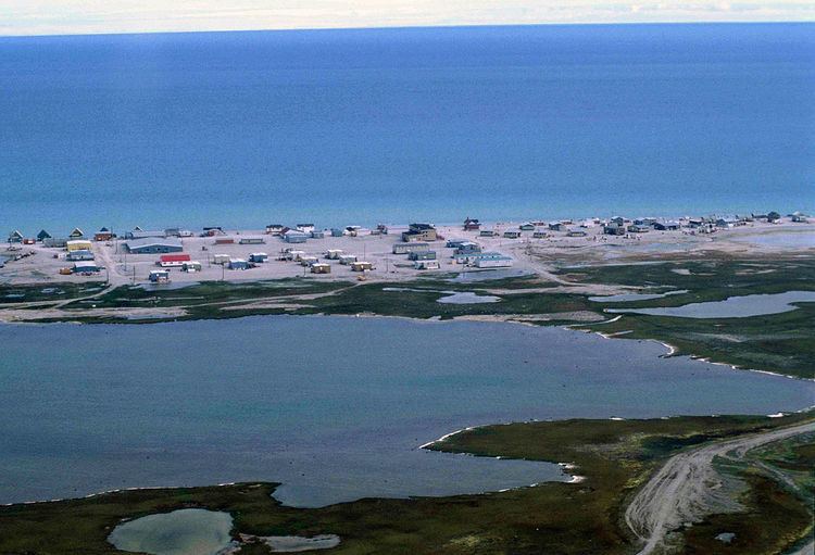
Hall Beach (Inuktitut: Sanirajak (the shoreline), Syllabics: ᓴᓂᕋᔭᒃ) is an Inuit settlement within the Qikiqtaaluk Region of Nunavut, Canada, approximately 69 km (43 mi) south of Igloolik.
Contents
- Map of Hall Beach NU Canada
- Dewline station fox main at hall beach 50 years later
- Demographics
- References
Map of Hall Beach, NU, Canada
It was established in 1957 during the construction of a Distant Early Warning (DEW) site. Currently the settlement is home to a North Warning System (68°45′44″N 081°13′44″W) radar facility and the Hall Beach Airport.
In 1971, seven sounding rockets of the Tomahawk Sandia type were launched from Hall Beach, some reaching altitudes of 270 km (170 mi).
Dewline station fox main at hall beach 50 years later
Demographics
In the 2016 Census, Statistics Canada originally reported that Hall Beach had a population of 848 living in 174 of its 189 total dwellings, a 15.2% increase from its 2011 population of 736.
References
Hall Beach Wikipedia(Text) CC BY-SA