
Length 390 km | Source Hazaran | |
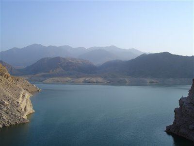 | ||
Halīl River (also Haliri River, known as the Kharan or Zar Dasht River in its upper reaches) is a river stretching for some 390 kilometres (240 mi) running in the Jiroft and Kahnuj districts of Kerman Province, Iran. It rises at 3,300 metres (10,800 ft) above sea level in the Hazar mountains about 100 kilometres (62 mi) to the north-west of Jiroft, flowing to the south-west until it is joined by the Rudar and Rabar rivers. Turning towards the south, if flows along the foothills of the Barez mountains, then to the south-east until Jiroft Dam, which is 130 metres (430 ft) high, about 40 kilometres (25 mi) upstream of Jiroft 28°51′30″N 57°28′0″E) at the confluence with the Narab. It passes some 15 kilometres (9 mi) east of Kahnuj and terminates in the Hamun-e Jaz Murian of Baluchistan.
Contents
Map of Halil River, Iran
The climate of the Halil Rud or Halilrood (Rud or Rood means "river" in Persian) basin is extremely hot in summer and of moderate temperature in winter. It is one of the hottest places in Iran and the world, with recorded temperatures as high as 57 °C (135 °F) in August 1933. The basin contains the site of the Bronze Age Jiroft culture.
The Halil riverbanks are subject to periodical flooding, including the historical flood which destroyed Jiroft in ca. AD 1000, and one in 1993.